You are here: Home > Network List > US - United States National Seismic Network Stations List
> Station WMOK Wichita Mountains, Oklahoma, USA > Earthquake Result Viewer
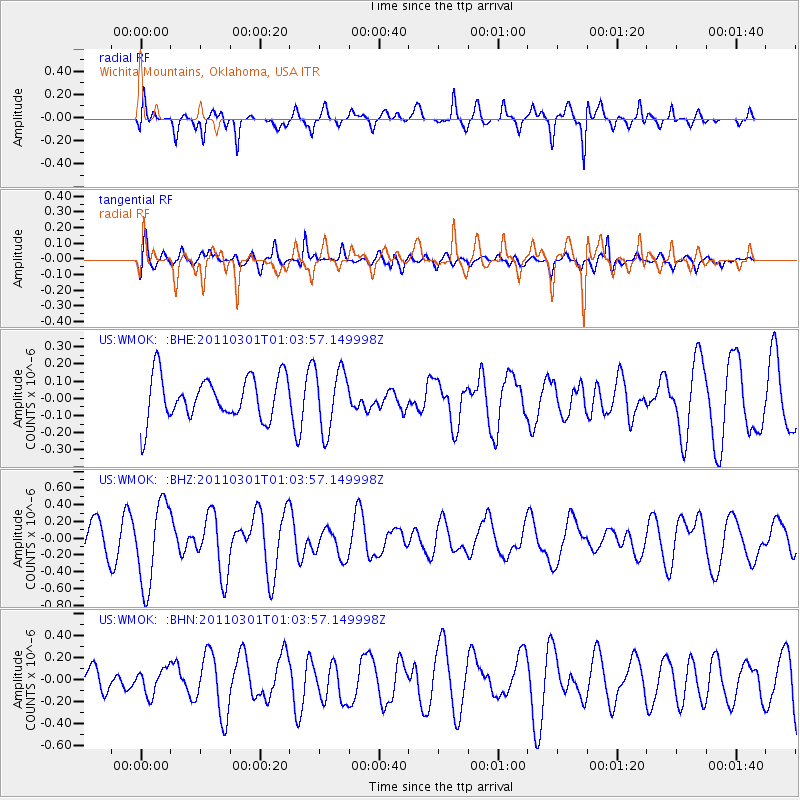
WMOK Wichita Mountains, Oklahoma, USA - Earthquake Result Viewer
*The percent match for this event was below the threshold and hence no stack was calculated.
| Earthquake location: |
Easter Island Region |
| Earthquake latitude/longitude: |
-29.7/-112.0 |
| Earthquake time(UTC): |
2011/03/01 (060) 00:53:46 GMT |
| Earthquake Depth: |
10 km |
| Earthquake Magnitude: |
5.6 MB, 6.0 MS, 6.1 MW, 6.0 MW |
| Earthquake Catalog/Contributor: |
WHDF/NEIC |
|
| Network: |
US United States National Seismic Network |
| Station: |
WMOK Wichita Mountains, Oklahoma, USA |
| Lat/Lon: |
34.74 N/98.78 W |
| Elevation: |
486 m |
|
| Distance: |
65.3 deg |
| Az: |
11.947 deg |
| Baz: |
192.632 deg |
| Ray Param: |
$rayparam |
*The percent match for this event was below the threshold and hence was not used in the summary stack. |
|
| Radial Match: |
69.86209 % |
| Radial Bump: |
400 |
| Transverse Match: |
49.09763 % |
| Transverse Bump: |
400 |
| SOD ConfigId: |
353373 |
| Insert Time: |
2011-08-01 09:02:07.161 +0000 |
| GWidth: |
2.5 |
| Max Bumps: |
400 |
| Tol: |
0.001 |
|
Signal To Noise
| Channel | StoN | STA | LTA |
| US:WMOK: :BHZ:20110301T01:03:57.149998Z | 3.0635288 | 4.926349E-7 | 1.6080637E-7 |
| US:WMOK: :BHN:20110301T01:03:57.149998Z | 0.6404241 | 1.17712325E-7 | 1.8380372E-7 |
| US:WMOK: :BHE:20110301T01:03:57.149998Z | 1.4194604 | 1.781602E-7 | 1.2551263E-7 |
| Arrivals |
| Ps | |
| PpPs | |
| PsPs/PpSs | |


