You are here: Home > Network List > US - United States National Seismic Network Stations List
> Station AMTX Amarillo, Texas, USA > Earthquake Result Viewer
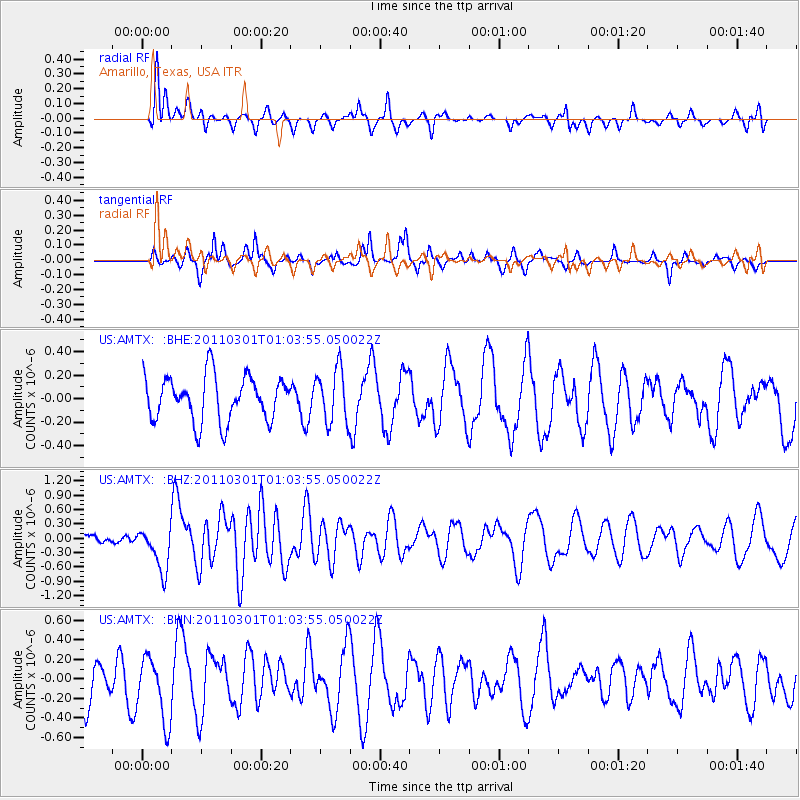
AMTX Amarillo, Texas, USA - Earthquake Result Viewer
*The percent match for this event was below the threshold and hence no stack was calculated.
| Earthquake location: |
Easter Island Region |
| Earthquake latitude/longitude: |
-29.7/-112.0 |
| Earthquake time(UTC): |
2011/03/01 (060) 00:53:46 GMT |
| Earthquake Depth: |
10 km |
| Earthquake Magnitude: |
5.6 MB, 6.0 MS, 6.1 MW, 6.0 MW |
| Earthquake Catalog/Contributor: |
WHDF/NEIC |
|
| Network: |
US United States National Seismic Network |
| Station: |
AMTX Amarillo, Texas, USA |
| Lat/Lon: |
34.53 N/101.41 W |
| Elevation: |
1010 m |
|
| Distance: |
64.7 deg |
| Az: |
9.649 deg |
| Baz: |
190.173 deg |
| Ray Param: |
$rayparam |
*The percent match for this event was below the threshold and hence was not used in the summary stack. |
|
| Radial Match: |
51.59207 % |
| Radial Bump: |
400 |
| Transverse Match: |
59.787216 % |
| Transverse Bump: |
279 |
| SOD ConfigId: |
353373 |
| Insert Time: |
2011-08-01 09:07:13.977 +0000 |
| GWidth: |
2.5 |
| Max Bumps: |
400 |
| Tol: |
0.001 |
|
Signal To Noise
| Channel | StoN | STA | LTA |
| US:AMTX: :BHZ:20110301T01:03:55.050022Z | 3.5116348 | 4.5963196E-7 | 1.3088831E-7 |
| US:AMTX: :BHN:20110301T01:03:55.050022Z | 1.1682235 | 3.3408793E-7 | 2.8597947E-7 |
| US:AMTX: :BHE:20110301T01:03:55.050022Z | 1.0134904 | 1.9930859E-7 | 1.9665563E-7 |
| Arrivals |
| Ps | |
| PpPs | |
| PsPs/PpSs | |


