You are here: Home > Network List > US - United States National Seismic Network Stations List
> Station TPNV Topopah Spring, Nevada, USA > Earthquake Result Viewer
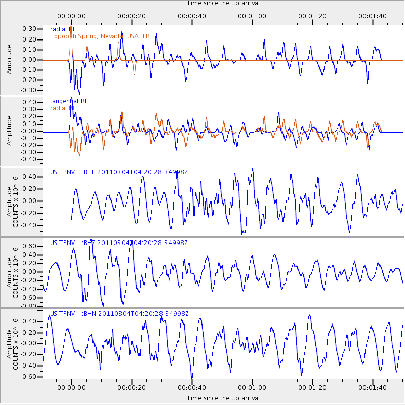
TPNV Topopah Spring, Nevada, USA - Earthquake Result Viewer
*The percent match for this event was below the threshold and hence no stack was calculated.
| Earthquake location: |
Solomon Islands |
| Earthquake latitude/longitude: |
-8.9/157.2 |
| Earthquake time(UTC): |
2011/03/04 (063) 04:07:48 GMT |
| Earthquake Depth: |
10 km |
| Earthquake Magnitude: |
5.6 MB, 5.2 MS, 5.6 MW, 5.6 MW |
| Earthquake Catalog/Contributor: |
WHDF/NEIC |
|
| Network: |
US United States National Seismic Network |
| Station: |
TPNV Topopah Spring, Nevada, USA |
| Lat/Lon: |
36.95 N/116.25 W |
| Elevation: |
1600 m |
|
| Distance: |
92.5 deg |
| Az: |
53.169 deg |
| Baz: |
260.811 deg |
| Ray Param: |
$rayparam |
*The percent match for this event was below the threshold and hence was not used in the summary stack. |
|
| Radial Match: |
68.06916 % |
| Radial Bump: |
400 |
| Transverse Match: |
72.88194 % |
| Transverse Bump: |
400 |
| SOD ConfigId: |
353373 |
| Insert Time: |
2011-08-01 09:45:13.587 +0000 |
| GWidth: |
2.5 |
| Max Bumps: |
400 |
| Tol: |
0.001 |
|
Signal To Noise
| Channel | StoN | STA | LTA |
| US:TPNV: :BHZ:20110304T04:20:28.34998Z | 2.3278024 | 3.7973933E-7 | 1.6313211E-7 |
| US:TPNV: :BHN:20110304T04:20:28.34998Z | 0.8611341 | 1.9117492E-7 | 2.2200365E-7 |
| US:TPNV: :BHE:20110304T04:20:28.34998Z | 1.2546283 | 2.1998216E-7 | 1.7533652E-7 |
| Arrivals |
| Ps | |
| PpPs | |
| PsPs/PpSs | |


