
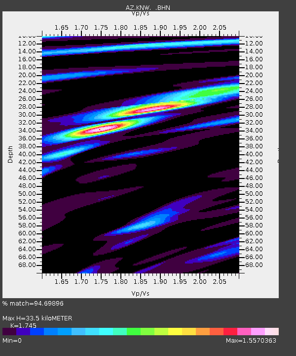
KNW AZ.KNW - Earthquake Result Viewer
| ||||||||||||||||||
| ||||||||||||||||||
| ||||||||||||||||||
|
Signal To Noise
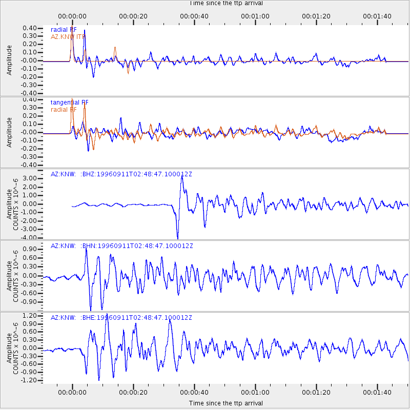
| Channel | StoN | STA | LTA |
| AZ:KNW: :BHN:19960911T02:48:47.100012Z | 1.4738985 | 2.6787154E-7 | 1.8174354E-7 |
| AZ:KNW: :BHE:19960911T02:48:47.100012Z | 3.1096716 | 3.1523754E-7 | 1.0137326E-7 |
| AZ:KNW: :BHZ:19960911T02:48:47.100012Z | 11.207936 | 1.2888116E-6 | 1.1499098E-7 |
| Arrivals | |
| Ps | 4.1 SECOND |
| PpPs | 14 SECOND |
| PsPs/PpSs | 18 SECOND |

