KNW AZ.KNW - Earthquake Result Viewer
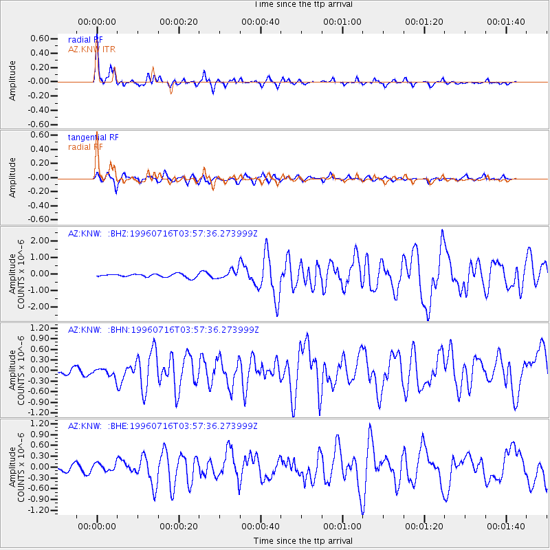
Earthquake location: Komandorskiye Ostrova Region
Earthquake latitude/longitude: 56.1/165.0
Earthquake time(UTC): 1996/07/16 (198) 03:48:28 GMT
Earthquake Depth: 33 km
Earthquake Magnitude: 5.8 MB, 6.4 MS, 6.5 UNKNOWN, 6.3 MW
Earthquake Catalog/Contributor: WHDF/NEIC
Network: AZ ANZA Regional Network
Station: KNW AZ.KNW
Lat/Lon: 33.71 N/116.71 W
Elevation: 1507 m
Distance: 56.5 deg
Az: 78.261 deg
Baz: 318.819 deg
Ray Param: 0.06406085
Estimated Moho Depth: 34.0 km
Estimated Crust Vp/Vs: 1.73
Assumed Crust Vp: 6.264 km/s
Estimated Crust Vs: 3.631 km/s
Estimated Crust Poisson's Ratio: 0.25
Radial Match: 92.21246 %
Radial Bump: 338
Transverse Match: 84.05654 %
Transverse Bump: 400
SOD ConfigId: 6273
Insert Time: 2010-02-26 19:32:37.688 +0000
GWidth: 2.5
Max Bumps: 400
Tol: 0.001

Signal To Noise

ChannelStoNSTALTA
AZ:KNW: :BHN:19960716T03:57:36.273999Z1.39789221.4284129E-71.02183336E-7
AZ:KNW: :BHE:19960716T03:57:36.273999Z1.23743311.0396175E-78.401405E-8
AZ:KNW: :BHZ:19960716T03:57:36.273999Z3.06951363.0252525E-79.855804E-8
Arrivals
Ps4.1 SECOND
PpPs14 SECOND
PsPs/PpSs18 SECOND