You are here: Home > Network List > TA - USArray Transportable Network (new EarthScope stations) Stations List
> Station I28A Midland, SD, USA > Earthquake Result Viewer
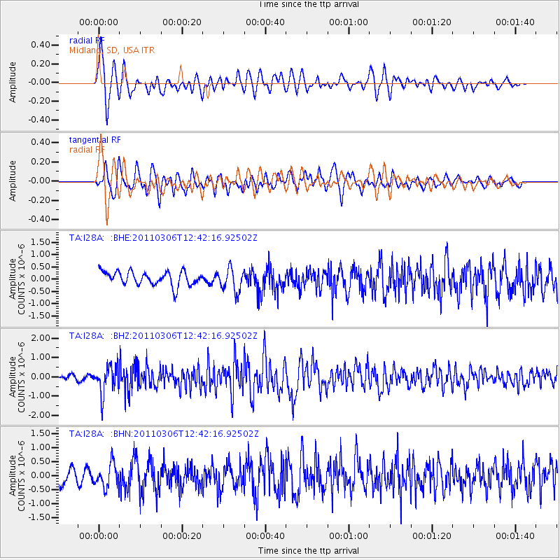
I28A Midland, SD, USA - Earthquake Result Viewer
*The percent match for this event was below the threshold and hence no stack was calculated.
| Earthquake location: |
Northern Chile |
| Earthquake latitude/longitude: |
-18.0/-69.4 |
| Earthquake time(UTC): |
2011/03/06 (065) 12:31:59 GMT |
| Earthquake Depth: |
118 km |
| Earthquake Magnitude: |
6.0 MB, 6.3 MW, 6.3 MW |
| Earthquake Catalog/Contributor: |
WHDF/NEIC |
|
| Network: |
TA USArray Transportable Network (new EarthScope stations) |
| Station: |
I28A Midland, SD, USA |
| Lat/Lon: |
44.00 N/101.17 W |
| Elevation: |
655 m |
|
| Distance: |
68.2 deg |
| Az: |
335.823 deg |
| Baz: |
147.316 deg |
| Ray Param: |
$rayparam |
*The percent match for this event was below the threshold and hence was not used in the summary stack. |
|
| Radial Match: |
64.22942 % |
| Radial Bump: |
400 |
| Transverse Match: |
65.939865 % |
| Transverse Bump: |
400 |
| SOD ConfigId: |
354511 |
| Insert Time: |
2011-08-09 07:23:12.200 +0000 |
| GWidth: |
2.5 |
| Max Bumps: |
400 |
| Tol: |
0.001 |
|
Signal To Noise
| Channel | StoN | STA | LTA |
| TA:I28A: :BHZ:20110306T12:42:16.92502Z | 6.664603 | 7.37882E-7 | 1.1071657E-7 |
| TA:I28A: :BHN:20110306T12:42:16.92502Z | 1.6263317 | 4.306119E-7 | 2.6477494E-7 |
| TA:I28A: :BHE:20110306T12:42:16.92502Z | 1.7111712 | 4.810339E-7 | 2.8111384E-7 |
| Arrivals |
| Ps | |
| PpPs | |
| PsPs/PpSs | |


