You are here: Home > Network List > TA - USArray Transportable Network (new EarthScope stations) Stations List
> Station X33A Lawton, OK, USA > Earthquake Result Viewer
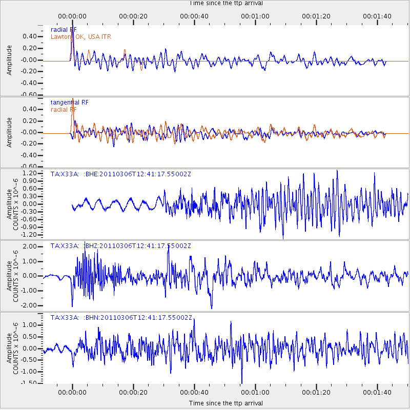
X33A Lawton, OK, USA - Earthquake Result Viewer
*The percent match for this event was below the threshold and hence no stack was calculated.
| Earthquake location: |
Northern Chile |
| Earthquake latitude/longitude: |
-18.0/-69.4 |
| Earthquake time(UTC): |
2011/03/06 (065) 12:31:59 GMT |
| Earthquake Depth: |
118 km |
| Earthquake Magnitude: |
6.0 MB, 6.3 MW, 6.3 MW |
| Earthquake Catalog/Contributor: |
WHDF/NEIC |
|
| Network: |
TA USArray Transportable Network (new EarthScope stations) |
| Station: |
X33A Lawton, OK, USA |
| Lat/Lon: |
34.54 N/98.50 W |
| Elevation: |
346 m |
|
| Distance: |
59.2 deg |
| Az: |
332.088 deg |
| Baz: |
147.344 deg |
| Ray Param: |
$rayparam |
*The percent match for this event was below the threshold and hence was not used in the summary stack. |
|
| Radial Match: |
75.09182 % |
| Radial Bump: |
400 |
| Transverse Match: |
70.45056 % |
| Transverse Bump: |
400 |
| SOD ConfigId: |
354511 |
| Insert Time: |
2011-08-09 07:37:56.427 +0000 |
| GWidth: |
2.5 |
| Max Bumps: |
400 |
| Tol: |
0.001 |
|
Signal To Noise
| Channel | StoN | STA | LTA |
| TA:X33A: :BHZ:20110306T12:41:17.55002Z | 5.8428698 | 8.729307E-7 | 1.4940102E-7 |
| TA:X33A: :BHN:20110306T12:41:17.55002Z | 2.9718323 | 2.999813E-7 | 1.00941534E-7 |
| TA:X33A: :BHE:20110306T12:41:17.55002Z | 1.6853199 | 2.250364E-7 | 1.3352741E-7 |
| Arrivals |
| Ps | |
| PpPs | |
| PsPs/PpSs | |


