You are here: Home > Network List > TA - USArray Transportable Network (new EarthScope stations) Stations List
> Station L32A Elgin, NE, USA > Earthquake Result Viewer
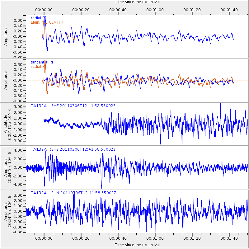
L32A Elgin, NE, USA - Earthquake Result Viewer
*The percent match for this event was below the threshold and hence no stack was calculated.
| Earthquake location: |
Northern Chile |
| Earthquake latitude/longitude: |
-18.0/-69.4 |
| Earthquake time(UTC): |
2011/03/06 (065) 12:31:59 GMT |
| Earthquake Depth: |
118 km |
| Earthquake Magnitude: |
6.0 MB, 6.3 MW, 6.3 MW |
| Earthquake Catalog/Contributor: |
WHDF/NEIC |
|
| Network: |
TA USArray Transportable Network (new EarthScope stations) |
| Station: |
L32A Elgin, NE, USA |
| Lat/Lon: |
42.00 N/98.01 W |
| Elevation: |
586 m |
|
| Distance: |
65.3 deg |
| Az: |
336.847 deg |
| Baz: |
149.868 deg |
| Ray Param: |
$rayparam |
*The percent match for this event was below the threshold and hence was not used in the summary stack. |
|
| Radial Match: |
75.81338 % |
| Radial Bump: |
400 |
| Transverse Match: |
75.4335 % |
| Transverse Bump: |
400 |
| SOD ConfigId: |
354511 |
| Insert Time: |
2011-08-09 08:17:04.967 +0000 |
| GWidth: |
2.5 |
| Max Bumps: |
400 |
| Tol: |
0.001 |
|
Signal To Noise
| Channel | StoN | STA | LTA |
| TA:L32A: :BHZ:20110306T12:41:58.55002Z | 4.1281714 | 1.7658133E-6 | 4.2774712E-7 |
| TA:L32A: :BHN:20110306T12:41:58.55002Z | 2.3933294 | 1.2667531E-6 | 5.2928493E-7 |
| TA:L32A: :BHE:20110306T12:41:58.55002Z | 1.4074908 | 6.6723595E-7 | 4.740606E-7 |
| Arrivals |
| Ps | |
| PpPs | |
| PsPs/PpSs | |


