KNW AZ.KNW - Earthquake Result Viewer
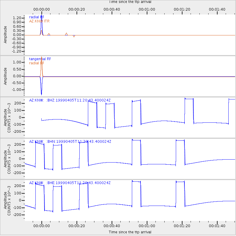
Earthquake location: New Britain Region, P.N.G.
Earthquake latitude/longitude: -5.6/149.6
Earthquake time(UTC): 1999/04/05 (095) 11:08:04 GMT
Earthquake Depth: 150 km
Earthquake Magnitude: 6.2 MB, 7.0 MS, 7.4 MW, 7.3 ME
Earthquake Catalog/Contributor: WHDF/NEIC
Network: AZ ANZA Regional Network
Station: KNW AZ.KNW
Lat/Lon: 33.71 N/116.71 W
Elevation: 1507 m
Distance: 96.2 deg
Az: 56.783 deg
Baz: 267.406 deg
Ray Param: 0.04047107
Estimated Moho Depth: 10.0 km
Estimated Crust Vp/Vs: 1.60
Assumed Crust Vp: 6.264 km/s
Estimated Crust Vs: 3.915 km/s
Estimated Crust Poisson's Ratio: 0.18
Radial Match: 100.0 %
Radial Bump: 2
Transverse Match: 100.0 %
Transverse Bump: 2
SOD ConfigId: 32974
Insert Time: 2010-02-26 19:33:43.650 +0000
GWidth: 2.5
Max Bumps: 400
Tol: 0.001

Signal To Noise

ChannelStoNSTALTA
AZ:KNW: :BHN:19990405T11:20:43.400024Z9.17550.182230550.019860558
AZ:KNW: :BHE:19990405T11:20:43.400024Z9.1754490.182233050.019860938
AZ:KNW: :BHZ:19990405T11:20:43.400024Z9.1754990.182231370.01986065
Arrivals
Ps1.0 SECOND
PpPs4.1 SECOND
PsPs/PpSs5.0 SECOND