You are here: Home > Network List > TA - USArray Transportable Network (new EarthScope stations) Stations List
> Station P56A Dayton Farm, Ripley, WV, USA > Earthquake Result Viewer
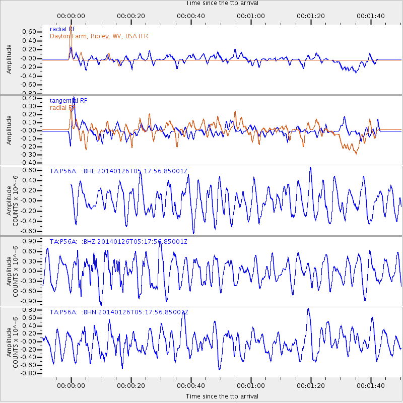
P56A Dayton Farm, Ripley, WV, USA - Earthquake Result Viewer
*The percent match for this event was below the threshold and hence no stack was calculated.
| Earthquake location: |
Peru-Ecuador Border Region |
| Earthquake latitude/longitude: |
-3.8/-80.9 |
| Earthquake time(UTC): |
2014/01/26 (026) 05:10:28 GMT |
| Earthquake Depth: |
20 km |
| Earthquake Magnitude: |
5.3 MW |
| Earthquake Catalog/Contributor: |
ISC/ISC |
|
| Network: |
TA USArray Transportable Network (new EarthScope stations) |
| Station: |
P56A Dayton Farm, Ripley, WV, USA |
| Lat/Lon: |
39.50 N/78.84 W |
| Elevation: |
249 m |
|
| Distance: |
43.2 deg |
| Az: |
2.287 deg |
| Baz: |
182.95 deg |
| Ray Param: |
$rayparam |
*The percent match for this event was below the threshold and hence was not used in the summary stack. |
|
| Radial Match: |
36.92253 % |
| Radial Bump: |
400 |
| Transverse Match: |
63.329872 % |
| Transverse Bump: |
400 |
| SOD ConfigId: |
3390531 |
| Insert Time: |
2019-04-10 02:52:55.379 +0000 |
| GWidth: |
2.5 |
| Max Bumps: |
400 |
| Tol: |
0.001 |
|
Signal To Noise
| Channel | StoN | STA | LTA |
| TA:P56A: :BHZ:20140126T05:17:56.85001Z | 1.0768807 | 3.6419286E-7 | 3.381924E-7 |
| TA:P56A: :BHN:20140126T05:17:56.85001Z | 0.8478696 | 3.4944014E-7 | 4.1213903E-7 |
| TA:P56A: :BHE:20140126T05:17:56.85001Z | 0.92711323 | 2.0746596E-7 | 2.237763E-7 |
| Arrivals |
| Ps | |
| PpPs | |
| PsPs/PpSs | |


