You are here: Home > Network List > G - GEOSCOPE Stations List
> Station TAM Tamanrasset, Algeria > Earthquake Result Viewer
TAM Tamanrasset, Algeria - Earthquake Result Viewer

| Earthquake location: |
South Sandwich Islands Region |
| Earthquake latitude/longitude: |
-56.4/-27.1 |
| Earthquake time(UTC): |
2011/03/06 (065) 14:32:36 GMT |
| Earthquake Depth: |
88 km |
| Earthquake Magnitude: |
6.6 MB, 6.5 MW, 6.5 MW |
| Earthquake Catalog/Contributor: |
WHDF/NEIC |
|
| Network: |
G GEOSCOPE |
| Station: |
TAM Tamanrasset, Algeria |
| Lat/Lon: |
22.79 N/5.53 E |
| Elevation: |
1377 m |
|
| Distance: |
83.6 deg |
| Az: |
30.014 deg |
| Baz: |
197.528 deg |
| Ray Param: |
0.04590179 |
| Estimated Moho Depth: |
36.75 km |
| Estimated Crust Vp/Vs: |
1.66 |
| Assumed Crust Vp: |
6.61 km/s |
| Estimated Crust Vs: |
3.988 km/s |
| Estimated Crust Poisson's Ratio: |
0.21 |
|
| Radial Match: |
98.56764 % |
| Radial Bump: |
281 |
| Transverse Match: |
92.26105 % |
| Transverse Bump: |
400 |
| SOD ConfigId: |
354511 |
| Insert Time: |
2011-08-09 09:23:30.819 +0000 |
| GWidth: |
2.5 |
| Max Bumps: |
400 |
| Tol: |
0.001 |
|
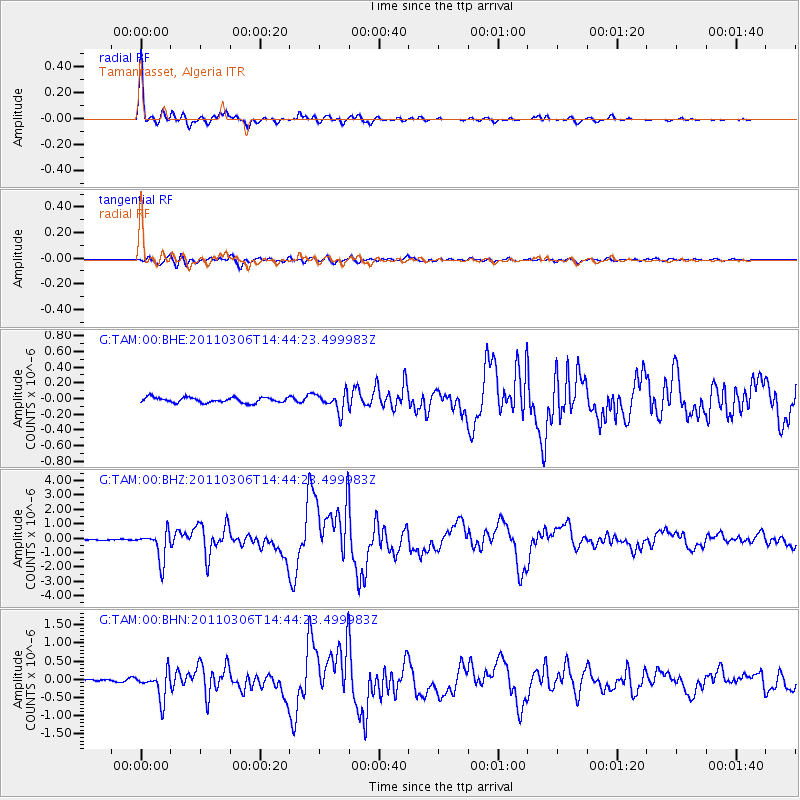
Signal To Noise
| Channel | StoN | STA | LTA |
| G:TAM:00:BHZ:20110306T14:44:23.499983Z | 25.15606 | 1.0170467E-6 | 4.0429487E-8 |
| G:TAM:00:BHN:20110306T14:44:23.499983Z | 11.032615 | 3.7515824E-7 | 3.4004472E-8 |
| G:TAM:00:BHE:20110306T14:44:23.499983Z | 3.4730902 | 1.1673392E-7 | 3.3610966E-8 |
| Arrivals |
| Ps | 3.8 SECOND |
| PpPs | 14 SECOND |
| PsPs/PpSs | 18 SECOND |


