You are here: Home > Network List > TA - USArray Transportable Network (new EarthScope stations) Stations List
> Station V55A Taylorsville, NC, USA > Earthquake Result Viewer
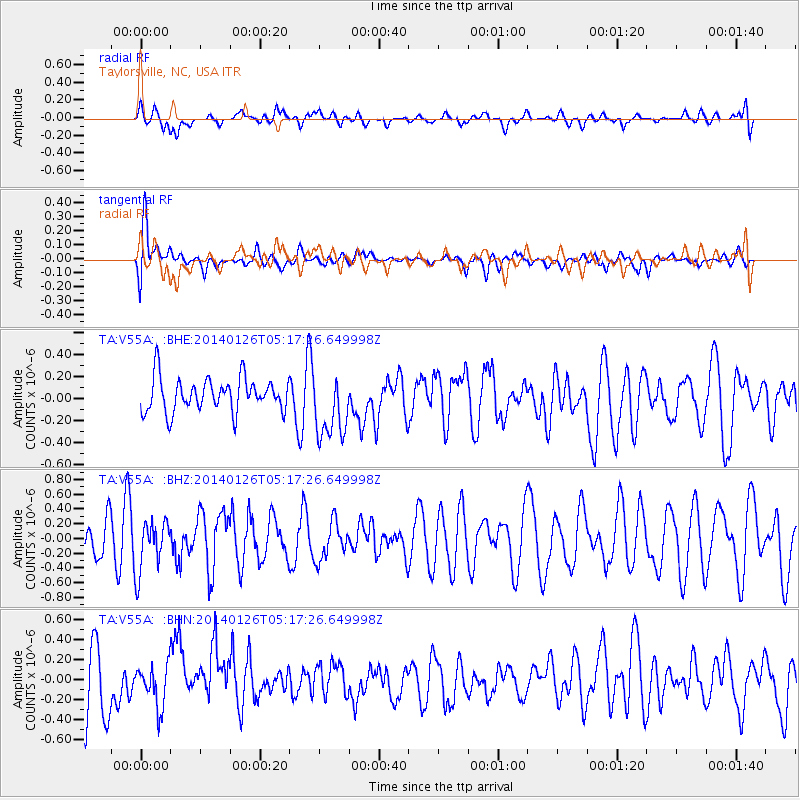
V55A Taylorsville, NC, USA - Earthquake Result Viewer
*The percent match for this event was below the threshold and hence no stack was calculated.
| Earthquake location: |
Peru-Ecuador Border Region |
| Earthquake latitude/longitude: |
-3.8/-80.9 |
| Earthquake time(UTC): |
2014/01/26 (026) 05:10:28 GMT |
| Earthquake Depth: |
20 km |
| Earthquake Magnitude: |
5.3 MW |
| Earthquake Catalog/Contributor: |
ISC/ISC |
|
| Network: |
TA USArray Transportable Network (new EarthScope stations) |
| Station: |
V55A Taylorsville, NC, USA |
| Lat/Lon: |
35.85 N/81.21 W |
| Elevation: |
306 m |
|
| Distance: |
39.5 deg |
| Az: |
359.548 deg |
| Baz: |
179.445 deg |
| Ray Param: |
$rayparam |
*The percent match for this event was below the threshold and hence was not used in the summary stack. |
|
| Radial Match: |
48.644978 % |
| Radial Bump: |
400 |
| Transverse Match: |
57.27247 % |
| Transverse Bump: |
400 |
| SOD ConfigId: |
3390531 |
| Insert Time: |
2019-04-10 02:53:15.162 +0000 |
| GWidth: |
2.5 |
| Max Bumps: |
400 |
| Tol: |
0.001 |
|
Signal To Noise
| Channel | StoN | STA | LTA |
| TA:V55A: :BHZ:20140126T05:17:26.649998Z | 0.91272 | 3.4547585E-7 | 3.7851242E-7 |
| TA:V55A: :BHN:20140126T05:17:26.649998Z | 0.7222751 | 2.0267028E-7 | 2.8059983E-7 |
| TA:V55A: :BHE:20140126T05:17:26.649998Z | 1.9702858 | 2.9959602E-7 | 1.5205714E-7 |
| Arrivals |
| Ps | |
| PpPs | |
| PsPs/PpSs | |


