You are here: Home > Network List > US - United States National Seismic Network Stations List
> Station MNTX Cornudas Mountains, Texas, USA > Earthquake Result Viewer
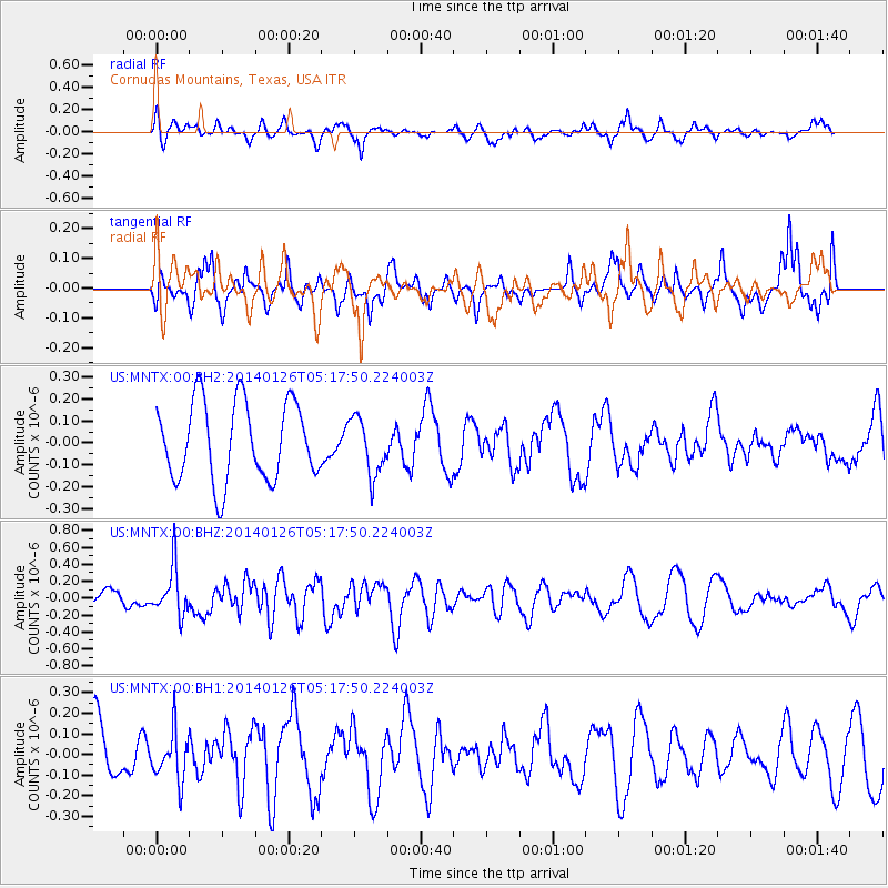
MNTX Cornudas Mountains, Texas, USA - Earthquake Result Viewer
*The percent match for this event was below the threshold and hence no stack was calculated.
| Earthquake location: |
Peru-Ecuador Border Region |
| Earthquake latitude/longitude: |
-3.8/-80.9 |
| Earthquake time(UTC): |
2014/01/26 (026) 05:10:28 GMT |
| Earthquake Depth: |
20 km |
| Earthquake Magnitude: |
5.3 MW |
| Earthquake Catalog/Contributor: |
ISC/ISC |
|
| Network: |
US United States National Seismic Network |
| Station: |
MNTX Cornudas Mountains, Texas, USA |
| Lat/Lon: |
31.70 N/105.38 W |
| Elevation: |
404 m |
|
| Distance: |
42.3 deg |
| Az: |
328.32 deg |
| Baz: |
142.067 deg |
| Ray Param: |
$rayparam |
*The percent match for this event was below the threshold and hence was not used in the summary stack. |
|
| Radial Match: |
54.570095 % |
| Radial Bump: |
395 |
| Transverse Match: |
54.87317 % |
| Transverse Bump: |
336 |
| SOD ConfigId: |
3390531 |
| Insert Time: |
2019-04-10 02:53:46.353 +0000 |
| GWidth: |
2.5 |
| Max Bumps: |
400 |
| Tol: |
0.001 |
|
Signal To Noise
| Channel | StoN | STA | LTA |
| US:MNTX:00:BHZ:20140126T05:17:50.224003Z | 2.5452745 | 2.774834E-7 | 1.0901905E-7 |
| US:MNTX:00:BH1:20140126T05:17:50.224003Z | 0.8577908 | 1.17724575E-7 | 1.3724159E-7 |
| US:MNTX:00:BH2:20140126T05:17:50.224003Z | 0.7300298 | 1.3023092E-7 | 1.7839123E-7 |
| Arrivals |
| Ps | |
| PpPs | |
| PsPs/PpSs | |


