You are here: Home > Network List > US - United States National Seismic Network Stations List
> Station MIAR Mount Ida, Arkansas, USA > Earthquake Result Viewer
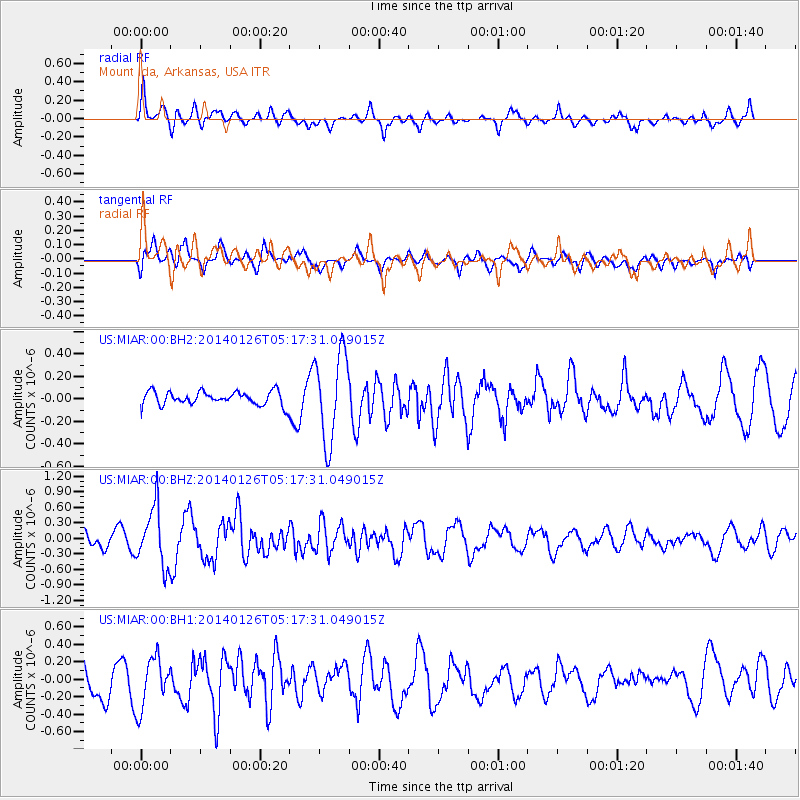
MIAR Mount Ida, Arkansas, USA - Earthquake Result Viewer
*The percent match for this event was below the threshold and hence no stack was calculated.
| Earthquake location: |
Peru-Ecuador Border Region |
| Earthquake latitude/longitude: |
-3.8/-80.9 |
| Earthquake time(UTC): |
2014/01/26 (026) 05:10:28 GMT |
| Earthquake Depth: |
20 km |
| Earthquake Magnitude: |
5.3 MW |
| Earthquake Catalog/Contributor: |
ISC/ISC |
|
| Network: |
US United States National Seismic Network |
| Station: |
MIAR Mount Ida, Arkansas, USA |
| Lat/Lon: |
34.55 N/93.58 W |
| Elevation: |
207 m |
|
| Distance: |
40.0 deg |
| Az: |
343.585 deg |
| Baz: |
160.026 deg |
| Ray Param: |
$rayparam |
*The percent match for this event was below the threshold and hence was not used in the summary stack. |
|
| Radial Match: |
55.50982 % |
| Radial Bump: |
400 |
| Transverse Match: |
65.437416 % |
| Transverse Bump: |
400 |
| SOD ConfigId: |
3390531 |
| Insert Time: |
2019-04-10 02:53:46.737 +0000 |
| GWidth: |
2.5 |
| Max Bumps: |
400 |
| Tol: |
0.001 |
|
Signal To Noise
| Channel | StoN | STA | LTA |
| US:MIAR:00:BHZ:20140126T05:17:31.049015Z | 2.2875583 | 5.5849404E-7 | 2.441442E-7 |
| US:MIAR:00:BH1:20140126T05:17:31.049015Z | 1.8837439 | 2.894801E-7 | 1.5367276E-7 |
| US:MIAR:00:BH2:20140126T05:17:31.049015Z | 6.4245424 | 3.908847E-7 | 6.0842424E-8 |
| Arrivals |
| Ps | |
| PpPs | |
| PsPs/PpSs | |


