You are here: Home > Network List > US - United States National Seismic Network Stations List
> Station EGMT Eagleton, Montana, USA > Earthquake Result Viewer
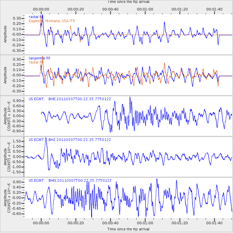
EGMT Eagleton, Montana, USA - Earthquake Result Viewer
*The percent match for this event was below the threshold and hence no stack was calculated.
| Earthquake location: |
Solomon Islands |
| Earthquake latitude/longitude: |
-10.3/160.8 |
| Earthquake time(UTC): |
2011/03/07 (066) 00:09:36 GMT |
| Earthquake Depth: |
22 km |
| Earthquake Magnitude: |
6.2 MB, 6.6 MS, 6.4 MW, 6.4 MW |
| Earthquake Catalog/Contributor: |
WHDF/NEIC |
|
| Network: |
US United States National Seismic Network |
| Station: |
EGMT Eagleton, Montana, USA |
| Lat/Lon: |
48.02 N/109.75 W |
| Elevation: |
1055 m |
|
| Distance: |
97.3 deg |
| Az: |
42.585 deg |
| Baz: |
262.677 deg |
| Ray Param: |
$rayparam |
*The percent match for this event was below the threshold and hence was not used in the summary stack. |
|
| Radial Match: |
76.461235 % |
| Radial Bump: |
400 |
| Transverse Match: |
58.407494 % |
| Transverse Bump: |
400 |
| SOD ConfigId: |
354511 |
| Insert Time: |
2011-08-09 10:44:42.813 +0000 |
| GWidth: |
2.5 |
| Max Bumps: |
400 |
| Tol: |
0.001 |
|
Signal To Noise
| Channel | StoN | STA | LTA |
| US:EGMT: :BHZ:20110307T00:22:35.775012Z | 9.631349 | 8.792164E-7 | 9.128694E-8 |
| US:EGMT: :BHN:20110307T00:22:35.775012Z | 1.2905049 | 2.265025E-7 | 1.7551461E-7 |
| US:EGMT: :BHE:20110307T00:22:35.775012Z | 2.2527783 | 3.5342717E-7 | 1.5688502E-7 |
| Arrivals |
| Ps | |
| PpPs | |
| PsPs/PpSs | |


