CMB Columbia College, Columbia, CA - Earthquake Result Viewer
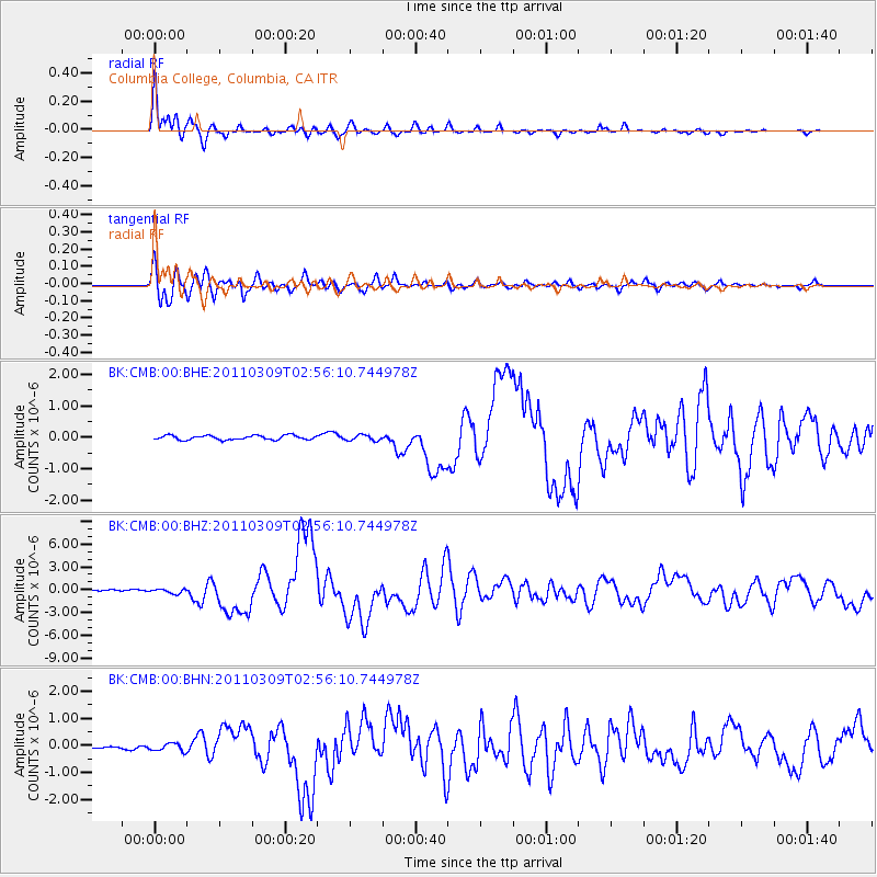
Earthquake location: Near East Coast Of Honshu, Japan
Earthquake latitude/longitude: 38.4/142.8
Earthquake time(UTC): 2011/03/09 (068) 02:45:20 GMT
Earthquake Depth: 32 km
Earthquake Magnitude: 6.4 MB, 7.3 MS, 7.5 MW, 7.3 MW
Earthquake Catalog/Contributor: WHDF/NEIC
Network: BK Berkeley Digital Seismograph Network
Station: CMB Columbia College, Columbia, CA
Lat/Lon: 38.03 N/120.39 W
Elevation: 697 m
Distance: 72.1 deg
Az: 55.471 deg
Baz: 304.98 deg
Ray Param: 0.05381303
Estimated Moho Depth: 12.25 km
Estimated Crust Vp/Vs: 2.10
Assumed Crust Vp: 6.597 km/s
Estimated Crust Vs: 3.145 km/s
Estimated Crust Poisson's Ratio: 0.35
Radial Match: 97.111694 %
Radial Bump: 400
Transverse Match: 94.169586 %
Transverse Bump: 400
SOD ConfigId: 354511
Insert Time: 2011-08-09 11:11:08.822 +0000
GWidth: 2.5
Max Bumps: 400
Tol: 0.001

Signal To Noise

ChannelStoNSTALTA
BK:CMB:00:BHZ:20110309T02:56:10.744978Z3.41097042.849536E-78.354032E-8
BK:CMB:00:BHN:20110309T02:56:10.744978Z2.14330031.3925393E-76.497173E-8
BK:CMB:00:BHE:20110309T02:56:10.744978Z1.31476778.8613376E-86.73985E-8
Arrivals
Ps2.1 SECOND
PpPs5.6 SECOND
PsPs/PpSs7.7 SECOND