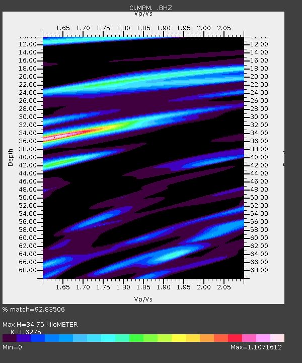
MPM Manuel Prospect Mine, California, USA - Earthquake Result Viewer
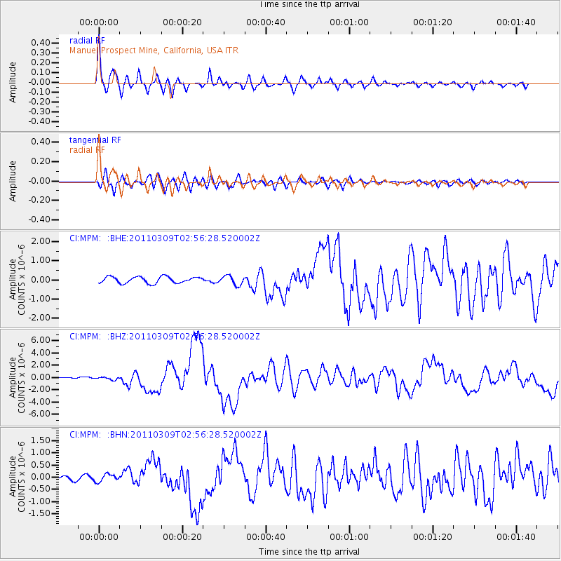
Earthquake location: Near East Coast Of Honshu, Japan
Earthquake latitude/longitude: 38.4/142.8
Earthquake time(UTC): 2011/03/09 (068) 02:45:20 GMT
Earthquake Depth: 32 km
Earthquake Magnitude: 6.4 MB, 7.3 MS, 7.5 MW, 7.3 MW
Earthquake Catalog/Contributor: WHDF/NEIC
Network: CI Caltech Regional Seismic Network
Station: MPM Manuel Prospect Mine, California, USA
Lat/Lon: 36.06 N/117.49 W
Elevation: 185 m
Distance: 75.2 deg
Az: 55.72 deg
Baz: 306.789 deg
Ray Param: 0.051801573
Estimated Moho Depth: 34.75 km
Estimated Crust Vp/Vs: 1.63
Assumed Crust Vp: 6.279 km/s
Estimated Crust Vs: 3.858 km/s
Estimated Crust Poisson's Ratio: 0.20
Radial Match: 92.83506 %
Radial Bump: 391
Transverse Match: 80.94582 %
Transverse Bump: 400
SOD ConfigId: 354511
Insert Time: 2011-08-09 11:18:34.010 +0000
GWidth: 2.5
Max Bumps: 400
Tol: 0.001

Signal To Noise

ChannelStoNSTALTA
CI:MPM: :BHZ:20110309T02:56:28.520002Z2.35946682.3276081E-79.864976E-8
CI:MPM: :BHN:20110309T02:56:28.520002Z1.88044521.5388649E-78.183514E-8
CI:MPM: :BHE:20110309T02:56:28.520002Z1.4546572.400023E-71.6498893E-7
Arrivals
Ps3.6 SECOND
PpPs14 SECOND
PsPs/PpSs18 SECOND