BFS Mt Baldy Forest Station - Earthquake Result Viewer
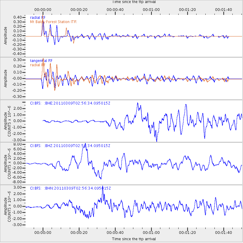
Earthquake location: Near East Coast Of Honshu, Japan
Earthquake latitude/longitude: 38.4/142.8
Earthquake time(UTC): 2011/03/09 (068) 02:45:20 GMT
Earthquake Depth: 32 km
Earthquake Magnitude: 6.4 MB, 7.3 MS, 7.5 MW, 7.3 MW
Earthquake Catalog/Contributor: WHDF/NEIC
Network: CI Caltech Regional Seismic Network
Station: BFS Mt Baldy Forest Station
Lat/Lon: 34.24 N/117.66 W
Elevation: 1312 m
Distance: 76.2 deg
Az: 57.304 deg
Baz: 307.084 deg
Ray Param: 0.05114133
Estimated Moho Depth: 32.5 km
Estimated Crust Vp/Vs: 1.79
Assumed Crust Vp: 6.276 km/s
Estimated Crust Vs: 3.511 km/s
Estimated Crust Poisson's Ratio: 0.27
Radial Match: 92.80152 %
Radial Bump: 400
Transverse Match: 87.71836 %
Transverse Bump: 400
SOD ConfigId: 354511
Insert Time: 2011-08-09 11:22:40.356 +0000
GWidth: 2.5
Max Bumps: 400
Tol: 0.001

Signal To Noise

ChannelStoNSTALTA
CI:BFS: :BHZ:20110309T02:56:34.095015Z2.06254322.8615366E-71.3873827E-7
CI:BFS: :BHN:20110309T02:56:34.095015Z2.4509191.8278024E-77.457621E-8
CI:BFS: :BHE:20110309T02:56:34.095015Z0.470738624.501137E-89.5618596E-8
Arrivals
Ps4.2 SECOND
PpPs14 SECOND
PsPs/PpSs18 SECOND