
FRB Iqaluit, Nunavut Territory, Canada - Earthquake Result Viewer
| ||||||||||||||||||
| ||||||||||||||||||
| ||||||||||||||||||
|
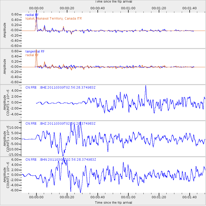
Signal To Noise
| Channel | StoN | STA | LTA |
| CN:FRB: :BHZ:20110309T02:56:28.374983Z | 16.689056 | 3.533444E-6 | 2.1172221E-7 |
| CN:FRB: :BHN:20110309T02:56:28.374983Z | 6.529229 | 1.3958021E-6 | 2.1377745E-7 |
| CN:FRB: :BHE:20110309T02:56:28.374983Z | 3.7276795 | 7.5311266E-7 | 2.0203257E-7 |
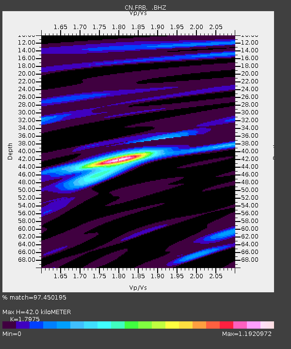
| Arrivals | |
| Ps | 5.4 SECOND |
| PpPs | 18 SECOND |
| PsPs/PpSs | 23 SECOND |

