
CLF Chambon la Foret observatory, France - Earthquake Result Viewer
| ||||||||||||||||||
| ||||||||||||||||||
| ||||||||||||||||||
|
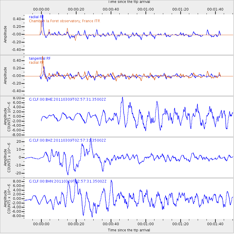
Signal To Noise
| Channel | StoN | STA | LTA |
| G:CLF:00:BHZ:20110309T02:57:31.35002Z | 7.3871837 | 3.7274915E-6 | 5.04589E-7 |
| G:CLF:00:BHN:20110309T02:57:31.35002Z | 1.5958999 | 1.3395872E-6 | 8.39393E-7 |
| G:CLF:00:BHE:20110309T02:57:31.35002Z | 1.7970595 | 1.7498232E-6 | 9.737147E-7 |
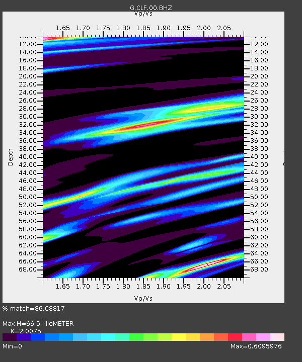
| Arrivals | |
| Ps | 11 SECOND |
| PpPs | 32 SECOND |
| PsPs/PpSs | 43 SECOND |

