You are here: Home > Network List > GE - GEOFON Stations List
> Station UGM GEOFON Station Wanagama, Indonesia > Earthquake Result Viewer
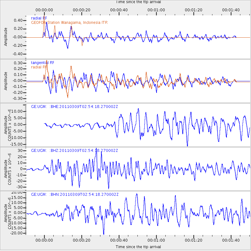
UGM GEOFON Station Wanagama, Indonesia - Earthquake Result Viewer
*The percent match for this event was below the threshold and hence no stack was calculated.
| Earthquake location: |
Near East Coast Of Honshu, Japan |
| Earthquake latitude/longitude: |
38.4/142.8 |
| Earthquake time(UTC): |
2011/03/09 (068) 02:45:20 GMT |
| Earthquake Depth: |
32 km |
| Earthquake Magnitude: |
6.4 MB, 7.3 MS, 7.5 MW, 7.3 MW |
| Earthquake Catalog/Contributor: |
WHDF/NEIC |
|
| Network: |
GE GEOFON |
| Station: |
UGM GEOFON Station Wanagama, Indonesia |
| Lat/Lon: |
7.91 S/110.52 E |
| Elevation: |
350 m |
|
| Distance: |
55.1 deg |
| Az: |
220.248 deg |
| Baz: |
30.812 deg |
| Ray Param: |
$rayparam |
*The percent match for this event was below the threshold and hence was not used in the summary stack. |
|
| Radial Match: |
81.57797 % |
| Radial Bump: |
400 |
| Transverse Match: |
80.29555 % |
| Transverse Bump: |
400 |
| SOD ConfigId: |
354511 |
| Insert Time: |
2011-08-09 11:33:06.916 +0000 |
| GWidth: |
2.5 |
| Max Bumps: |
400 |
| Tol: |
0.001 |
|
Signal To Noise
| Channel | StoN | STA | LTA |
| GE:UGM: :BHZ:20110309T02:54:18.270002Z | 5.150846 | 6.012608E-6 | 1.1673048E-6 |
| GE:UGM: :BHN:20110309T02:54:18.270002Z | 1.4997377 | 1.0559033E-6 | 7.040587E-7 |
| GE:UGM: :BHE:20110309T02:54:18.270002Z | 1.5641385 | 1.298413E-6 | 8.3011383E-7 |
| Arrivals |
| Ps | |
| PpPs | |
| PsPs/PpSs | |


