USP KN.USP - Earthquake Result Viewer
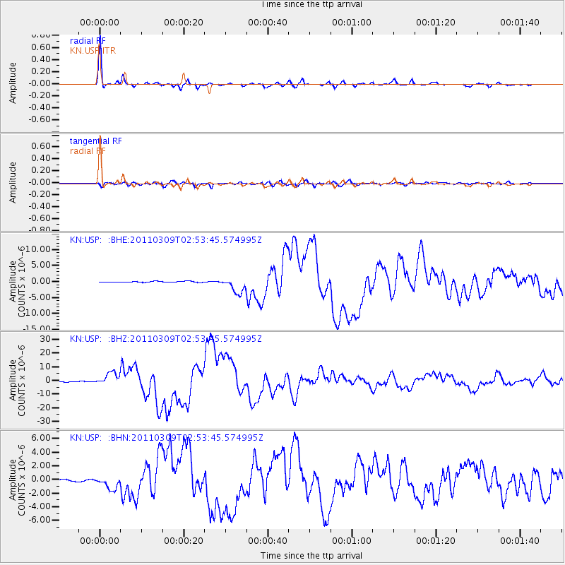
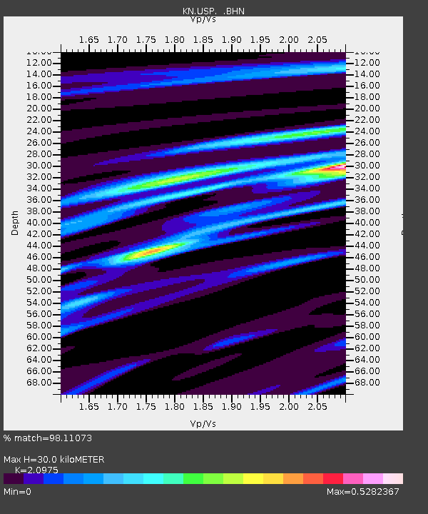
Earthquake location: Near East Coast Of Honshu, Japan
Earthquake latitude/longitude: 38.4/142.8
Earthquake time(UTC): 2011/03/09 (068) 02:45:20 GMT
Earthquake Depth: 32 km
Earthquake Magnitude: 6.4 MB, 7.3 MS, 7.5 MW, 7.3 MW
Earthquake Catalog/Contributor: WHDF/NEIC
Network: KN Kyrgyz Seismic Telemetry Network
Station: USP KN.USP
Lat/Lon: 43.27 N/74.50 E
Elevation: 740 m
Distance: 50.6 deg
Az: 298.555 deg
Baz: 70.795 deg
Ray Param: 0.06787419
Estimated Moho Depth: 30.0 km
Estimated Crust Vp/Vs: 2.10
Assumed Crust Vp: 6.306 km/s
Estimated Crust Vs: 3.006 km/s
Estimated Crust Poisson's Ratio: 0.35
Radial Match: 98.11073 %
Radial Bump: 275
Transverse Match: 88.17813 %
Transverse Bump: 400
SOD ConfigId: 354511
Insert Time: 2011-08-09 11:44:26.248 +0000
GWidth: 2.5
Max Bumps: 400
Tol: 0.001

Signal To Noise

ChannelStoNSTALTA
KN:USP: :BHZ:20110309T02:53:45.574995Z24.434634.783572E-61.9577017E-7
KN:USP: :BHN:20110309T02:53:45.574995Z6.77172859.2752435E-71.369701E-7
KN:USP: :BHE:20110309T02:53:45.574995Z16.6908552.5326026E-61.5173595E-7
Arrivals
Ps5.5 SECOND
PpPs14 SECOND
PsPs/PpSs20 SECOND