
KZA KN.KZA - Earthquake Result Viewer
| ||||||||||||||||||
| ||||||||||||||||||
| ||||||||||||||||||
|
Signal To Noise
| Channel | StoN | STA | LTA |
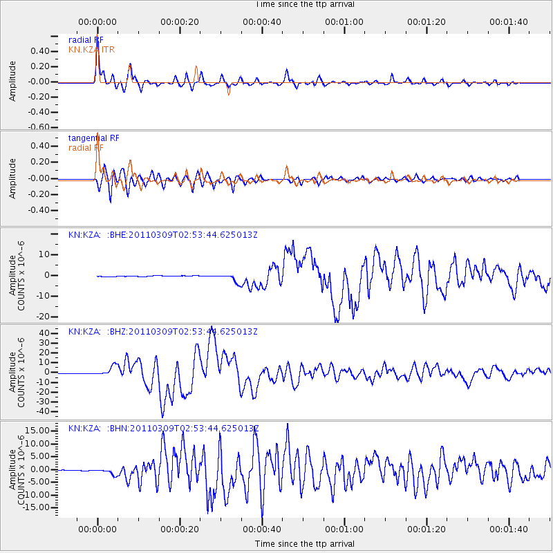
| KN:KZA: :BHZ:20110309T02:53:44.625013Z | 43.743374 | 5.3658514E-6 | 1.226666E-7 |
| KN:KZA: :BHN:20110309T02:53:44.625013Z | 10.125119 | 1.1945159E-6 | 1.1797549E-7 |
| KN:KZA: :BHE:20110309T02:53:44.625013Z | 11.171555 | 2.1629423E-6 | 1.936116E-7 |
| Arrivals | |
| Ps | 8.1 SECOND |
| PpPs | 25 SECOND |
| PsPs/PpSs | 33 SECOND |

