KBK KN.KBK - Earthquake Result Viewer
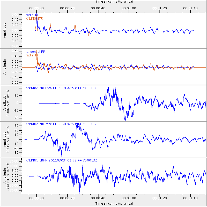
Earthquake location: Near East Coast Of Honshu, Japan
Earthquake latitude/longitude: 38.4/142.8
Earthquake time(UTC): 2011/03/09 (068) 02:45:20 GMT
Earthquake Depth: 32 km
Earthquake Magnitude: 6.4 MB, 7.3 MS, 7.5 MW, 7.3 MW
Earthquake Catalog/Contributor: WHDF/NEIC
Network: KN Kyrgyz Seismic Telemetry Network
Station: KBK KN.KBK
Lat/Lon: 42.66 N/74.95 E
Elevation: 1760 m
Distance: 50.5 deg
Az: 297.669 deg
Baz: 70.536 deg
Ray Param: 0.067947626
Estimated Moho Depth: 16.0 km
Estimated Crust Vp/Vs: 1.60
Assumed Crust Vp: 6.306 km/s
Estimated Crust Vs: 3.941 km/s
Estimated Crust Poisson's Ratio: 0.18
Radial Match: 96.1304 %
Radial Bump: 400
Transverse Match: 89.61222 %
Transverse Bump: 400
SOD ConfigId: 354511
Insert Time: 2011-08-09 11:46:44.388 +0000
GWidth: 2.5
Max Bumps: 400
Tol: 0.001

Signal To Noise

ChannelStoNSTALTA
KN:KBK: :BHZ:20110309T02:53:44.750013Z10.8878464.5581014E-64.1864124E-7
KN:KBK: :BHN:20110309T02:53:44.750013Z5.3785191.3816235E-62.5687805E-7
KN:KBK: :BHE:20110309T02:53:44.750013Z12.8302632.5947104E-62.0223361E-7
Arrivals
Ps1.6 SECOND
PpPs6.2 SECOND
PsPs/PpSs7.8 SECOND