TIP Timpagrande, Italy - Earthquake Result Viewer
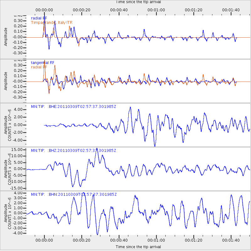
Earthquake location: Near East Coast Of Honshu, Japan
Earthquake latitude/longitude: 38.4/142.8
Earthquake time(UTC): 2011/03/09 (068) 02:45:20 GMT
Earthquake Depth: 32 km
Earthquake Magnitude: 6.4 MB, 7.3 MS, 7.5 MW, 7.3 MW
Earthquake Catalog/Contributor: WHDF/NEIC
Network: MN MEDNET Project
Station: TIP Timpagrande, Italy
Lat/Lon: 39.18 N/16.76 E
Elevation: 789 m
Distance: 88.3 deg
Az: 321.066 deg
Baz: 39.417 deg
Ray Param: 0.042663235
Estimated Moho Depth: 32.5 km
Estimated Crust Vp/Vs: 2.06
Assumed Crust Vp: 6.1 km/s
Estimated Crust Vs: 2.968 km/s
Estimated Crust Poisson's Ratio: 0.34
Radial Match: 93.937485 %
Radial Bump: 400
Transverse Match: 90.676506 %
Transverse Bump: 400
SOD ConfigId: 354511
Insert Time: 2011-08-09 11:54:00.524 +0000
GWidth: 2.5
Max Bumps: 400
Tol: 0.001

Signal To Noise

ChannelStoNSTALTA
MN:TIP: :BHZ:20110309T02:57:37.301985Z12.1802811.9833194E-61.6283035E-7
MN:TIP: :BHN:20110309T02:57:37.301985Z2.84585835.1427827E-71.8071113E-7
MN:TIP: :BHE:20110309T02:57:37.301985Z2.67670045.199079E-71.9423466E-7
Arrivals
Ps5.7 SECOND
PpPs16 SECOND
PsPs/PpSs22 SECOND