
R28A Tribune, KS, USA - Earthquake Result Viewer
| ||||||||||||||||||
| ||||||||||||||||||
| ||||||||||||||||||
|
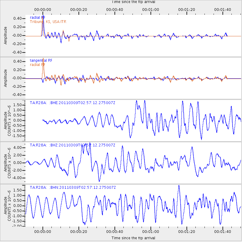
Signal To Noise
| Channel | StoN | STA | LTA |
| TA:R28A: :BHZ:20110309T02:57:12.275007Z | 2.9139082 | 7.2592627E-7 | 2.491246E-7 |
| TA:R28A: :BHN:20110309T02:57:12.275007Z | 1.2067504 | 6.5257143E-7 | 5.4076753E-7 |
| TA:R28A: :BHE:20110309T02:57:12.275007Z | 3.0892081 | 4.841326E-7 | 1.5671739E-7 |
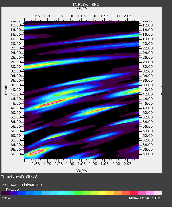
| Arrivals | |
| Ps | 6.9 SECOND |
| PpPs | 27 SECOND |
| PsPs/PpSs | 34 SECOND |

