
R30A Dighton, KS, USA - Earthquake Result Viewer
| ||||||||||||||||||
| ||||||||||||||||||
| ||||||||||||||||||
|
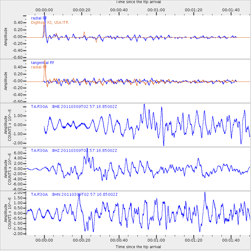
Signal To Noise
| Channel | StoN | STA | LTA |
| TA:R30A: :BHZ:20110309T02:57:16.85002Z | 2.189735 | 6.7589446E-7 | 3.0866497E-7 |
| TA:R30A: :BHN:20110309T02:57:16.85002Z | 0.84419954 | 2.888181E-7 | 3.4212064E-7 |
| TA:R30A: :BHE:20110309T02:57:16.85002Z | 1.9307352 | 6.6161533E-7 | 3.4267532E-7 |
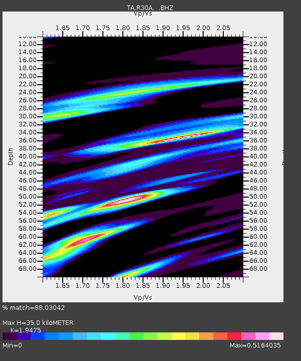
| Arrivals | |
| Ps | 5.2 SECOND |
| PpPs | 16 SECOND |
| PsPs/PpSs | 21 SECOND |

