P30A Selden, KS, USA - Earthquake Result Viewer
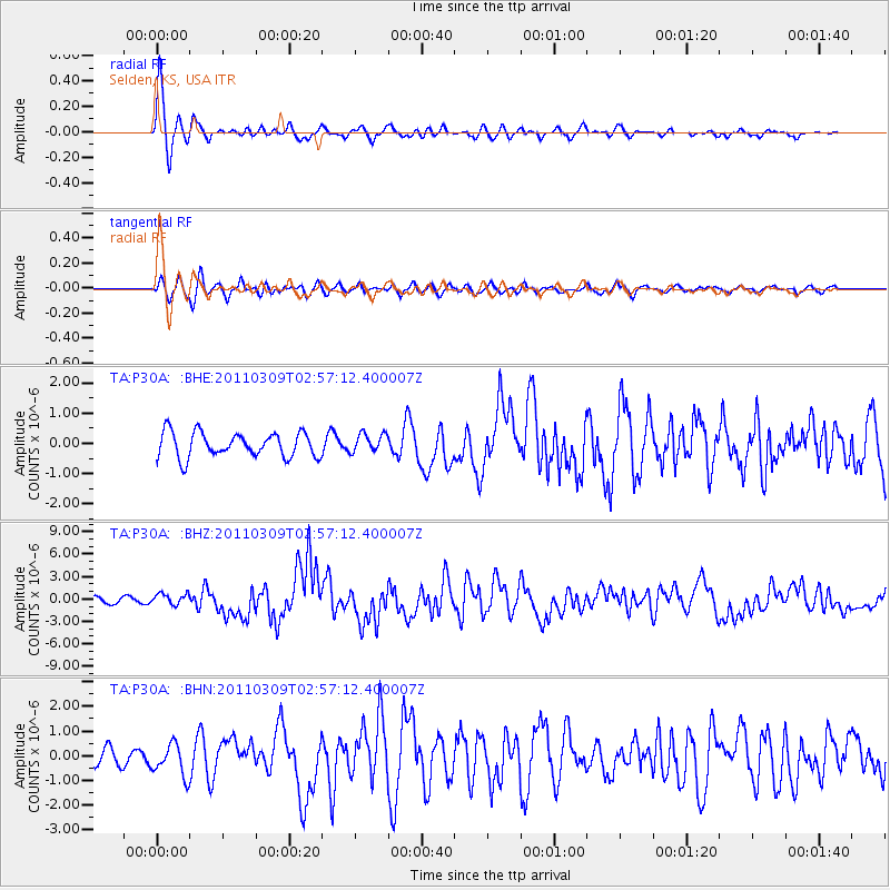
Earthquake location: Near East Coast Of Honshu, Japan
Earthquake latitude/longitude: 38.4/142.8
Earthquake time(UTC): 2011/03/09 (068) 02:45:20 GMT
Earthquake Depth: 32 km
Earthquake Magnitude: 6.4 MB, 7.3 MS, 7.5 MW, 7.3 MW
Earthquake Catalog/Contributor: WHDF/NEIC
Network: TA USArray Transportable Network (new EarthScope stations)
Station: P30A Selden, KS, USA
Lat/Lon: 39.54 N/100.25 W
Elevation: 788 m
Distance: 83.2 deg
Az: 43.973 deg
Baz: 315.154 deg
Ray Param: 0.046287484
Estimated Moho Depth: 10.0 km
Estimated Crust Vp/Vs: 1.60
Assumed Crust Vp: 6.483 km/s
Estimated Crust Vs: 4.052 km/s
Estimated Crust Poisson's Ratio: 0.18
Radial Match: 80.35184 %
Radial Bump: 332
Transverse Match: 75.454956 %
Transverse Bump: 400
SOD ConfigId: 354511
Insert Time: 2011-08-09 12:17:36.187 +0000
GWidth: 2.5
Max Bumps: 400
Tol: 0.001

Signal To Noise

ChannelStoNSTALTA
TA:P30A: :BHZ:20110309T02:57:12.400007Z1.83920377.4232423E-74.0361175E-7
TA:P30A: :BHN:20110309T02:57:12.400007Z1.89573866.375165E-73.3628925E-7
TA:P30A: :BHE:20110309T02:57:12.400007Z0.773930433.1395177E-74.056589E-7
Arrivals
Ps1.0 SECOND
PpPs3.9 SECOND
PsPs/PpSs4.8 SECOND