Q31A Ellis, KS, USA - Earthquake Result Viewer
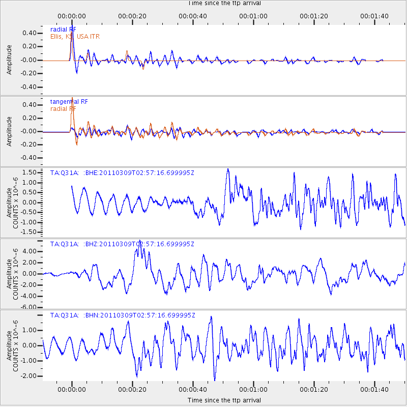
Earthquake location: Near East Coast Of Honshu, Japan
Earthquake latitude/longitude: 38.4/142.8
Earthquake time(UTC): 2011/03/09 (068) 02:45:20 GMT
Earthquake Depth: 32 km
Earthquake Magnitude: 6.4 MB, 7.3 MS, 7.5 MW, 7.3 MW
Earthquake Catalog/Contributor: WHDF/NEIC
Network: TA USArray Transportable Network (new EarthScope stations)
Station: Q31A Ellis, KS, USA
Lat/Lon: 39.00 N/99.39 W
Elevation: 680 m
Distance: 84.1 deg
Az: 43.88 deg
Baz: 315.681 deg
Ray Param: 0.045687895
Estimated Moho Depth: 44.25 km
Estimated Crust Vp/Vs: 1.76
Assumed Crust Vp: 6.483 km/s
Estimated Crust Vs: 3.673 km/s
Estimated Crust Poisson's Ratio: 0.26
Radial Match: 84.3178 %
Radial Bump: 400
Transverse Match: 60.05152 %
Transverse Bump: 400
SOD ConfigId: 354511
Insert Time: 2011-08-09 12:18:08.954 +0000
GWidth: 2.5
Max Bumps: 400
Tol: 0.001

Signal To Noise

ChannelStoNSTALTA
TA:Q31A: :BHZ:20110309T02:57:16.699995Z2.29631233.8621317E-71.6818844E-7
TA:Q31A: :BHN:20110309T02:57:16.699995Z1.51903984.9681256E-73.2705697E-7
TA:Q31A: :BHE:20110309T02:57:16.699995Z0.384752151.4492426E-73.7666913E-7
Arrivals
Ps5.4 SECOND
PpPs18 SECOND
PsPs/PpSs24 SECOND