H28A Mission Ridge, SD, USA - Earthquake Result Viewer
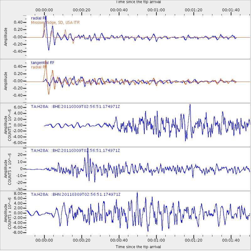
Earthquake location: Near East Coast Of Honshu, Japan
Earthquake latitude/longitude: 38.4/142.8
Earthquake time(UTC): 2011/03/09 (068) 02:45:20 GMT
Earthquake Depth: 32 km
Earthquake Magnitude: 6.4 MB, 7.3 MS, 7.5 MW, 7.3 MW
Earthquake Catalog/Contributor: WHDF/NEIC
Network: TA USArray Transportable Network (new EarthScope stations)
Station: H28A Mission Ridge, SD, USA
Lat/Lon: 44.68 N/101.02 W
Elevation: 642 m
Distance: 79.2 deg
Az: 40.692 deg
Baz: 314.136 deg
Ray Param: 0.049062923
Estimated Moho Depth: 12.0 km
Estimated Crust Vp/Vs: 1.60
Assumed Crust Vp: 6.53 km/s
Estimated Crust Vs: 4.082 km/s
Estimated Crust Poisson's Ratio: 0.18
Radial Match: 91.7167 %
Radial Bump: 400
Transverse Match: 90.0863 %
Transverse Bump: 400
SOD ConfigId: 354511
Insert Time: 2011-08-09 12:22:25.789 +0000
GWidth: 2.5
Max Bumps: 400
Tol: 0.001

Signal To Noise

ChannelStoNSTALTA
TA:H28A: :BHZ:20110309T02:56:51.174971Z6.96980671.1260199E-61.6155684E-7
TA:H28A: :BHN:20110309T02:56:51.174971Z0.58439984.124282E-77.057295E-7
TA:H28A: :BHE:20110309T02:56:51.174971Z0.95322754.01644E-74.2135167E-7
Arrivals
Ps1.1 SECOND
PpPs4.6 SECOND
PsPs/PpSs5.8 SECOND