I28A Midland, SD, USA - Earthquake Result Viewer
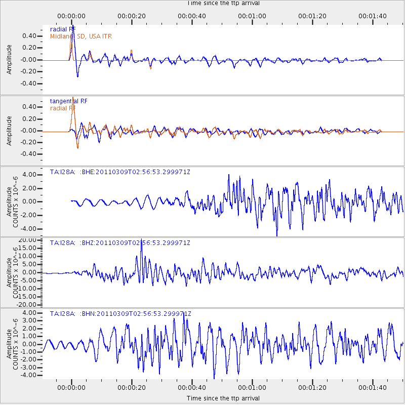
Earthquake location: Near East Coast Of Honshu, Japan
Earthquake latitude/longitude: 38.4/142.8
Earthquake time(UTC): 2011/03/09 (068) 02:45:20 GMT
Earthquake Depth: 32 km
Earthquake Magnitude: 6.4 MB, 7.3 MS, 7.5 MW, 7.3 MW
Earthquake Catalog/Contributor: WHDF/NEIC
Network: TA USArray Transportable Network (new EarthScope stations)
Station: I28A Midland, SD, USA
Lat/Lon: 44.00 N/101.17 W
Elevation: 655 m
Distance: 79.6 deg
Az: 41.261 deg
Baz: 314.137 deg
Ray Param: 0.048793245
Estimated Moho Depth: 47.25 km
Estimated Crust Vp/Vs: 1.83
Assumed Crust Vp: 6.483 km/s
Estimated Crust Vs: 3.542 km/s
Estimated Crust Poisson's Ratio: 0.29
Radial Match: 89.5494 %
Radial Bump: 400
Transverse Match: 81.49586 %
Transverse Bump: 400
SOD ConfigId: 354511
Insert Time: 2011-08-09 12:22:50.357 +0000
GWidth: 2.5
Max Bumps: 400
Tol: 0.001

Signal To Noise

ChannelStoNSTALTA
TA:I28A: :BHZ:20110309T02:56:53.299971Z4.61250167.481349E-71.6219721E-7
TA:I28A: :BHN:20110309T02:56:53.299971Z0.97447044.1330478E-74.241327E-7
TA:I28A: :BHE:20110309T02:56:53.299971Z1.08519763.8510487E-73.5487074E-7
Arrivals
Ps6.2 SECOND
PpPs20 SECOND
PsPs/PpSs26 SECOND