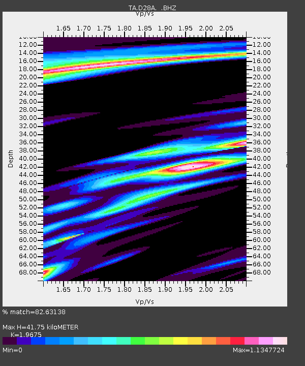
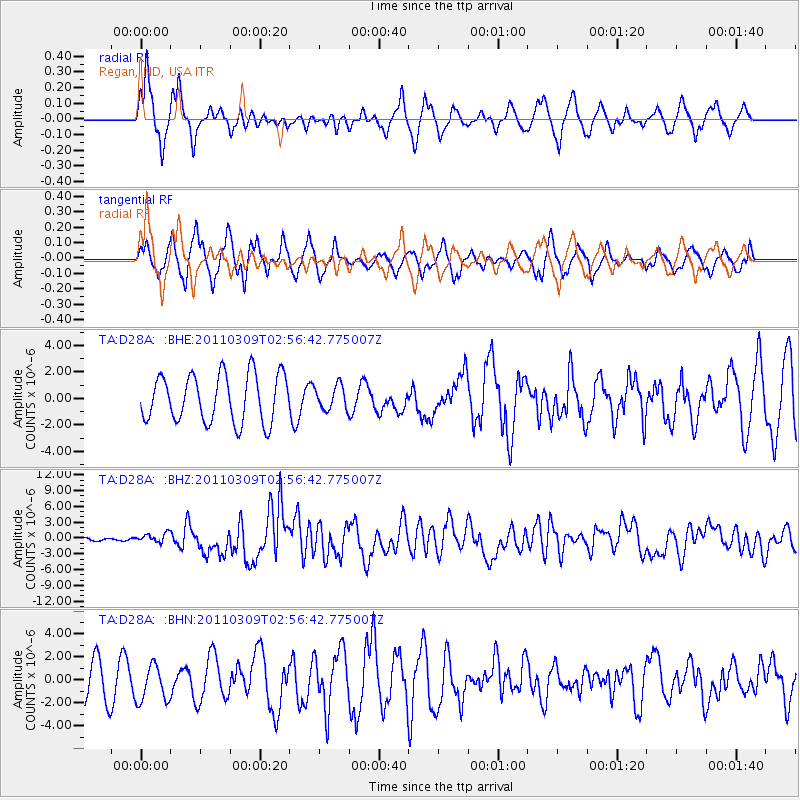
D28A Regan, ND, USA - Earthquake Result Viewer

Earthquake location: Near East Coast Of Honshu, Japan
Earthquake latitude/longitude: 38.4/142.8
Earthquake time(UTC): 2011/03/09 (068) 02:45:20 GMT
Earthquake Depth: 32 km
Earthquake Magnitude: 6.4 MB, 7.3 MS, 7.5 MW, 7.3 MW
Earthquake Catalog/Contributor: WHDF/NEIC
Network: TA USArray Transportable Network (new EarthScope stations)
Station: D28A Regan, ND, USA
Lat/Lon: 47.19 N/100.57 W
Elevation: 621 m
Distance: 77.7 deg
Az: 38.623 deg
Baz: 314.046 deg
Ray Param: 0.05010032
Estimated Moho Depth: 41.75 km
Estimated Crust Vp/Vs: 1.97
Assumed Crust Vp: 6.438 km/s
Estimated Crust Vs: 3.272 km/s
Estimated Crust Poisson's Ratio: 0.33
Radial Match: 82.63138 %
Radial Bump: 349
Transverse Match: 72.955734 %
Transverse Bump: 390
SOD ConfigId: 354511
Insert Time: 2011-08-09 12:26:40.392 +0000
GWidth: 2.5
Max Bumps: 400
Tol: 0.001

Signal To Noise

ChannelStoNSTALTA
TA:D28A: :BHZ:20110309T02:56:42.775007Z2.79202759.2602073E-73.3166606E-7
TA:D28A: :BHN:20110309T02:56:42.775007Z1.12800121.5977523E-61.4164456E-6
TA:D28A: :BHE:20110309T02:56:42.775007Z0.508399079.038242E-71.7777847E-6
Arrivals
Ps6.4 SECOND
PpPs19 SECOND
PsPs/PpSs25 SECOND