You are here: Home > Network List > CI - Caltech Regional Seismic Network Stations List
> Station MPM Manuel Prospect Mine, California, USA > Earthquake Result Viewer
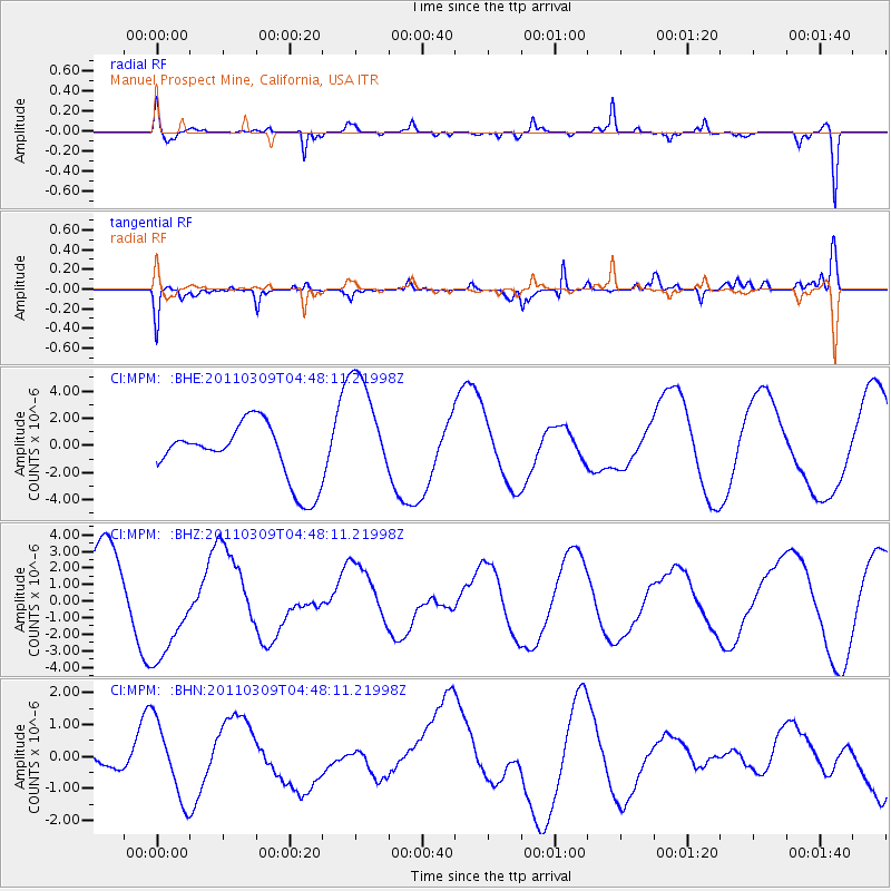
MPM Manuel Prospect Mine, California, USA - Earthquake Result Viewer
*The percent match for this event was below the threshold and hence no stack was calculated.
| Earthquake location: |
Near East Coast Of Honshu, Japan |
| Earthquake latitude/longitude: |
38.7/143.0 |
| Earthquake time(UTC): |
2011/03/09 (068) 04:37:04 GMT |
| Earthquake Depth: |
38 km |
| Earthquake Magnitude: |
5.6 MB |
| Earthquake Catalog/Contributor: |
WHDF/NEIC |
|
| Network: |
CI Caltech Regional Seismic Network |
| Station: |
MPM Manuel Prospect Mine, California, USA |
| Lat/Lon: |
36.06 N/117.49 W |
| Elevation: |
185 m |
|
| Distance: |
74.9 deg |
| Az: |
55.846 deg |
| Baz: |
306.917 deg |
| Ray Param: |
$rayparam |
*The percent match for this event was below the threshold and hence was not used in the summary stack. |
|
| Radial Match: |
31.277369 % |
| Radial Bump: |
226 |
| Transverse Match: |
47.942577 % |
| Transverse Bump: |
223 |
| SOD ConfigId: |
354511 |
| Insert Time: |
2011-08-09 13:00:51.547 +0000 |
| GWidth: |
2.5 |
| Max Bumps: |
400 |
| Tol: |
0.001 |
|
Signal To Noise
| Channel | StoN | STA | LTA |
| CI:MPM: :BHZ:20110309T04:48:11.21998Z | 1.8494142 | 3.082403E-6 | 1.6666914E-6 |
| CI:MPM: :BHN:20110309T04:48:11.21998Z | 1.2804236 | 1.2001155E-6 | 9.3728005E-7 |
| CI:MPM: :BHE:20110309T04:48:11.21998Z | 2.0143402 | 4.289072E-6 | 2.129269E-6 |
| Arrivals |
| Ps | |
| PpPs | |
| PsPs/PpSs | |


