
KNW AZ.KNW - Earthquake Result Viewer
| ||||||||||||||||||
| ||||||||||||||||||
| ||||||||||||||||||
|
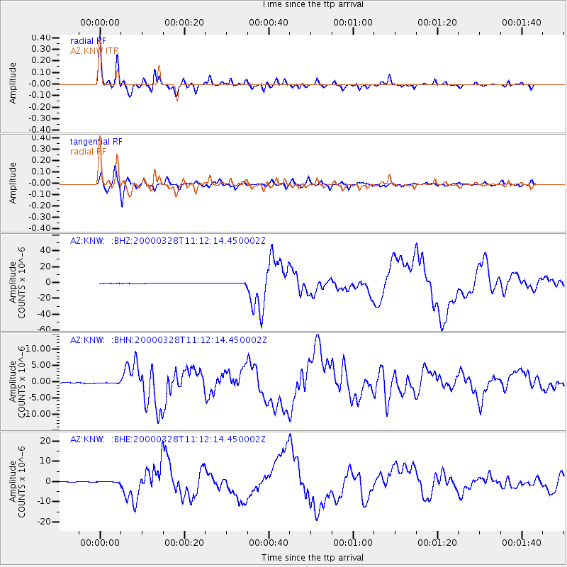
Signal To Noise
| Channel | StoN | STA | LTA |
| AZ:KNW: :BHN:20000328T11:12:14.450002Z | 1.0227437 | 1.07244794E-7 | 1.0485989E-7 |
| AZ:KNW: :BHE:20000328T11:12:14.450002Z | 1.6903052 | 3.4354207E-7 | 2.0324264E-7 |
| AZ:KNW: :BHZ:20000328T11:12:14.450002Z | 2.7906814 | 8.5799115E-7 | 3.074486E-7 |
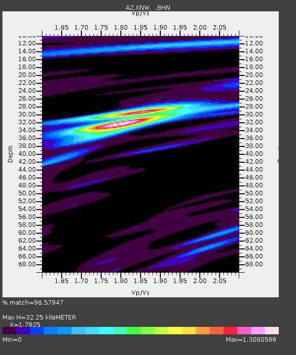
| Arrivals | |
| Ps | 4.2 SECOND |
| PpPs | 14 SECOND |
| PsPs/PpSs | 18 SECOND |

