You are here: Home > Network List > GS - US Geological Survey Networks Stations List
> Station DEC09 Decatur Surface Seismic Site, Decatur, IL, USA > Earthquake Result Viewer
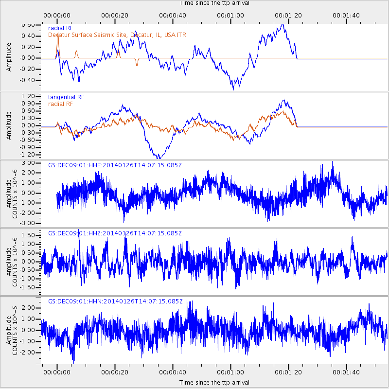
DEC09 Decatur Surface Seismic Site, Decatur, IL, USA - Earthquake Result Viewer
*The percent match for this event was below the threshold and hence no stack was calculated.
| Earthquake location: |
Greece |
| Earthquake latitude/longitude: |
38.2/20.5 |
| Earthquake time(UTC): |
2014/01/26 (026) 13:55:42 GMT |
| Earthquake Depth: |
8.0 km |
| Earthquake Magnitude: |
6.1 MWW, 6.1 MWB, 6.2 MWC |
| Earthquake Catalog/Contributor: |
NEIC PDE/NEIC COMCAT |
|
| Network: |
GS US Geological Survey Networks |
| Station: |
DEC09 Decatur Surface Seismic Site, Decatur, IL, USA |
| Lat/Lon: |
39.87 N/88.92 W |
| Elevation: |
207 m |
|
| Distance: |
78.9 deg |
| Az: |
312.289 deg |
| Baz: |
49.225 deg |
| Ray Param: |
$rayparam |
*The percent match for this event was below the threshold and hence was not used in the summary stack. |
|
| Radial Match: |
34.785545 % |
| Radial Bump: |
400 |
| Transverse Match: |
60.706238 % |
| Transverse Bump: |
400 |
| SOD ConfigId: |
3390531 |
| Insert Time: |
2019-04-10 03:08:57.895 +0000 |
| GWidth: |
2.5 |
| Max Bumps: |
400 |
| Tol: |
0.001 |
|
Signal To Noise
| Channel | StoN | STA | LTA |
| GS:DEC09:01:HHZ:20140126T14:07:15.085Z | 0.8011385 | 3.7599415E-7 | 4.6932476E-7 |
| GS:DEC09:01:HHN:20140126T14:07:15.085Z | 1.444602 | 1.1851148E-6 | 8.203745E-7 |
| GS:DEC09:01:HHE:20140126T14:07:15.085Z | 0.767912 | 6.7977385E-7 | 8.8522364E-7 |
| Arrivals |
| Ps | |
| PpPs | |
| PsPs/PpSs | |


