You are here: Home > Network List > TA - USArray Transportable Network (new EarthScope stations) Stations List
> Station O03D Paynes Creek, CA, USA > Earthquake Result Viewer
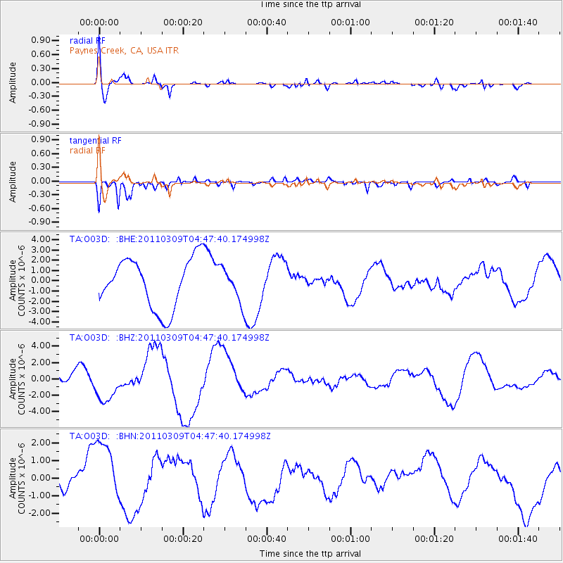
O03D Paynes Creek, CA, USA - Earthquake Result Viewer
*The percent match for this event was below the threshold and hence no stack was calculated.
| Earthquake location: |
Near East Coast Of Honshu, Japan |
| Earthquake latitude/longitude: |
38.7/143.0 |
| Earthquake time(UTC): |
2011/03/09 (068) 04:37:04 GMT |
| Earthquake Depth: |
38 km |
| Earthquake Magnitude: |
5.6 MB |
| Earthquake Catalog/Contributor: |
WHDF/NEIC |
|
| Network: |
TA USArray Transportable Network (new EarthScope stations) |
| Station: |
O03D Paynes Creek, CA, USA |
| Lat/Lon: |
40.29 N/121.80 W |
| Elevation: |
968 m |
|
| Distance: |
69.7 deg |
| Az: |
54.292 deg |
| Baz: |
303.788 deg |
| Ray Param: |
$rayparam |
*The percent match for this event was below the threshold and hence was not used in the summary stack. |
|
| Radial Match: |
50.873554 % |
| Radial Bump: |
400 |
| Transverse Match: |
66.53846 % |
| Transverse Bump: |
400 |
| SOD ConfigId: |
354511 |
| Insert Time: |
2011-08-09 13:21:54.620 +0000 |
| GWidth: |
2.5 |
| Max Bumps: |
400 |
| Tol: |
0.001 |
|
Signal To Noise
| Channel | StoN | STA | LTA |
| TA:O03D: :BHZ:20110309T04:47:40.174998Z | 1.4007169 | 2.2008783E-6 | 1.5712513E-6 |
| TA:O03D: :BHN:20110309T04:47:40.174998Z | 3.598252 | 1.8829579E-6 | 5.2329796E-7 |
| TA:O03D: :BHE:20110309T04:47:40.174998Z | 0.70009845 | 1.6991369E-6 | 2.426997E-6 |
| Arrivals |
| Ps | |
| PpPs | |
| PsPs/PpSs | |


