You are here: Home > Network List > TA - USArray Transportable Network (new EarthScope stations) Stations List
> Station A04D Lummi Island, WA, USA > Earthquake Result Viewer
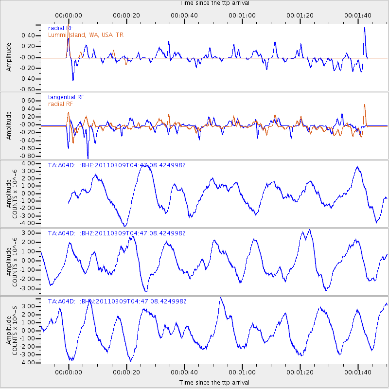
A04D Lummi Island, WA, USA - Earthquake Result Viewer
*The percent match for this event was below the threshold and hence no stack was calculated.
| Earthquake location: |
Near East Coast Of Honshu, Japan |
| Earthquake latitude/longitude: |
38.7/143.0 |
| Earthquake time(UTC): |
2011/03/09 (068) 04:37:04 GMT |
| Earthquake Depth: |
38 km |
| Earthquake Magnitude: |
5.6 MB |
| Earthquake Catalog/Contributor: |
WHDF/NEIC |
|
| Network: |
TA USArray Transportable Network (new EarthScope stations) |
| Station: |
A04D Lummi Island, WA, USA |
| Lat/Lon: |
48.72 N/122.71 W |
| Elevation: |
13 m |
|
| Distance: |
64.7 deg |
| Az: |
46.921 deg |
| Baz: |
300.294 deg |
| Ray Param: |
$rayparam |
*The percent match for this event was below the threshold and hence was not used in the summary stack. |
|
| Radial Match: |
55.24279 % |
| Radial Bump: |
400 |
| Transverse Match: |
72.92128 % |
| Transverse Bump: |
400 |
| SOD ConfigId: |
354511 |
| Insert Time: |
2011-08-09 13:22:13.632 +0000 |
| GWidth: |
2.5 |
| Max Bumps: |
400 |
| Tol: |
0.001 |
|
Signal To Noise
| Channel | StoN | STA | LTA |
| TA:A04D: :BHZ:20110309T04:47:08.424998Z | 0.5801184 | 1.0562588E-6 | 1.820764E-6 |
| TA:A04D: :BHN:20110309T04:47:08.424998Z | 2.4697955 | 2.6191565E-6 | 1.060475E-6 |
| TA:A04D: :BHE:20110309T04:47:08.424998Z | 0.8532627 | 1.6261547E-6 | 1.9058078E-6 |
| Arrivals |
| Ps | |
| PpPs | |
| PsPs/PpSs | |


