You are here: Home > Network List > TA - USArray Transportable Network (new EarthScope stations) Stations List
> Station K31A O'Neill, NE, USA > Earthquake Result Viewer
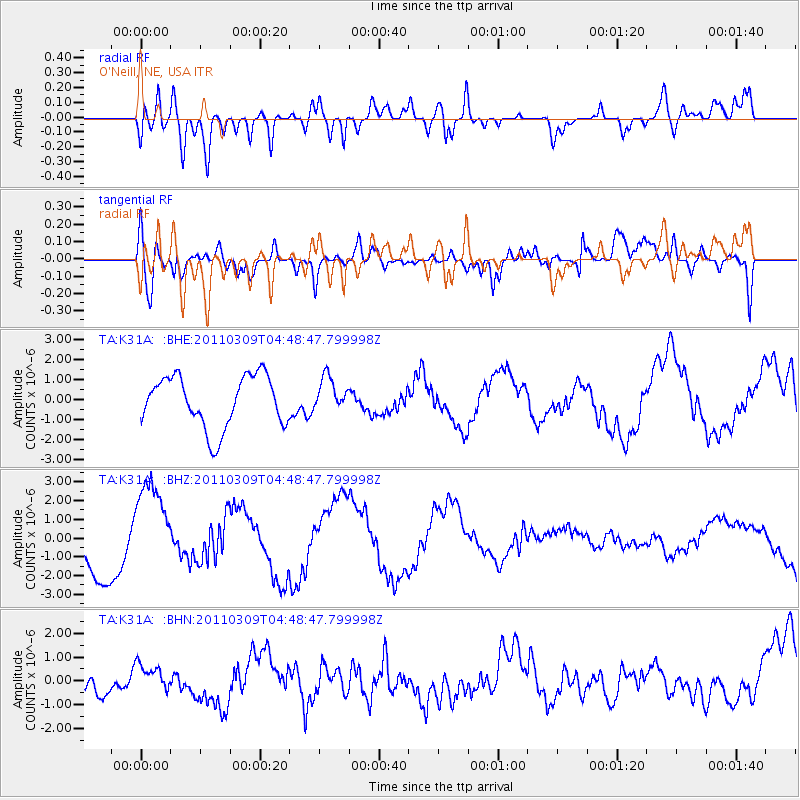
K31A O'Neill, NE, USA - Earthquake Result Viewer
*The percent match for this event was below the threshold and hence no stack was calculated.
| Earthquake location: |
Near East Coast Of Honshu, Japan |
| Earthquake latitude/longitude: |
38.7/143.0 |
| Earthquake time(UTC): |
2011/03/09 (068) 04:37:04 GMT |
| Earthquake Depth: |
38 km |
| Earthquake Magnitude: |
5.6 MB |
| Earthquake Catalog/Contributor: |
WHDF/NEIC |
|
| Network: |
TA USArray Transportable Network (new EarthScope stations) |
| Station: |
K31A O'Neill, NE, USA |
| Lat/Lon: |
42.62 N/98.75 W |
| Elevation: |
580 m |
|
| Distance: |
81.6 deg |
| Az: |
41.088 deg |
| Baz: |
315.807 deg |
| Ray Param: |
$rayparam |
*The percent match for this event was below the threshold and hence was not used in the summary stack. |
|
| Radial Match: |
61.806873 % |
| Radial Bump: |
400 |
| Transverse Match: |
74.62001 % |
| Transverse Bump: |
400 |
| SOD ConfigId: |
354511 |
| Insert Time: |
2011-08-09 13:22:30.561 +0000 |
| GWidth: |
2.5 |
| Max Bumps: |
400 |
| Tol: |
0.001 |
|
Signal To Noise
| Channel | StoN | STA | LTA |
| TA:K31A: :BHZ:20110309T04:48:47.799998Z | 1.7390723 | 2.4578374E-6 | 1.4133037E-6 |
| TA:K31A: :BHN:20110309T04:48:47.799998Z | 0.72014153 | 6.1500685E-7 | 8.540083E-7 |
| TA:K31A: :BHE:20110309T04:48:47.799998Z | 0.6643934 | 8.5072924E-7 | 1.2804601E-6 |
| Arrivals |
| Ps | |
| PpPs | |
| PsPs/PpSs | |


