You are here: Home > Network List > TA - USArray Transportable Network (new EarthScope stations) Stations List
> Station 243A Waterproof, LA, USA > Earthquake Result Viewer
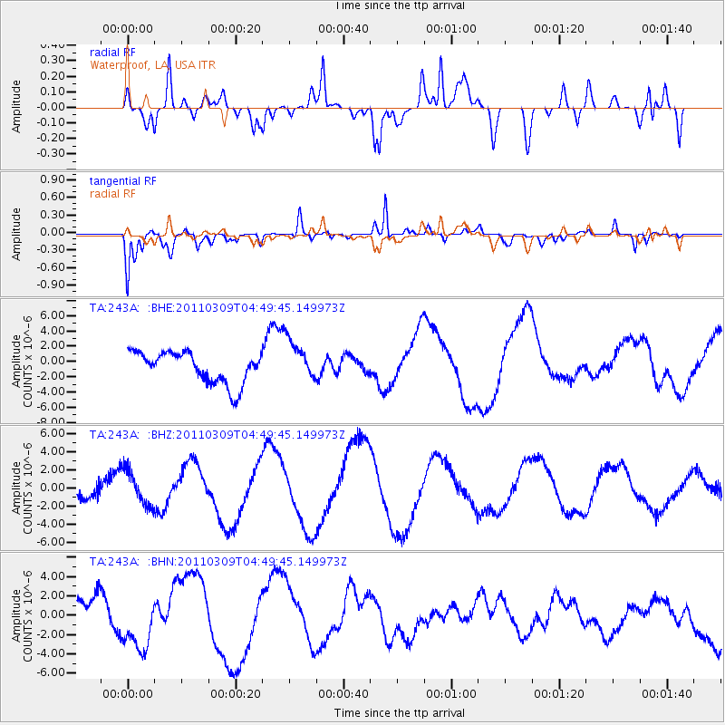
243A Waterproof, LA, USA - Earthquake Result Viewer
*The percent match for this event was below the threshold and hence no stack was calculated.
| Earthquake location: |
Near East Coast Of Honshu, Japan |
| Earthquake latitude/longitude: |
38.7/143.0 |
| Earthquake time(UTC): |
2011/03/09 (068) 04:37:04 GMT |
| Earthquake Depth: |
38 km |
| Earthquake Magnitude: |
5.6 MB |
| Earthquake Catalog/Contributor: |
WHDF/NEIC |
|
| Network: |
TA USArray Transportable Network (new EarthScope stations) |
| Station: |
243A Waterproof, LA, USA |
| Lat/Lon: |
31.88 N/91.48 W |
| Elevation: |
2.0 m |
|
| Distance: |
93.4 deg |
| Az: |
43.917 deg |
| Baz: |
320.337 deg |
| Ray Param: |
$rayparam |
*The percent match for this event was below the threshold and hence was not used in the summary stack. |
|
| Radial Match: |
46.76932 % |
| Radial Bump: |
400 |
| Transverse Match: |
69.77912 % |
| Transverse Bump: |
400 |
| SOD ConfigId: |
354511 |
| Insert Time: |
2011-08-09 13:27:29.719 +0000 |
| GWidth: |
2.5 |
| Max Bumps: |
400 |
| Tol: |
0.001 |
|
Signal To Noise
| Channel | StoN | STA | LTA |
| TA:243A: :BHZ:20110309T04:49:45.149973Z | 1.2761039 | 1.8612292E-6 | 1.4585249E-6 |
| TA:243A: :BHN:20110309T04:49:45.149973Z | 1.8596741 | 3.1074999E-6 | 1.6709917E-6 |
| TA:243A: :BHE:20110309T04:49:45.149973Z | 1.3136063 | 2.6953921E-6 | 2.0519026E-6 |
| Arrivals |
| Ps | |
| PpPs | |
| PsPs/PpSs | |


