You are here: Home > Network List > TA - USArray Transportable Network (new EarthScope stations) Stations List
> Station R11A Troy Canyon, Currant, NV, USA > Earthquake Result Viewer
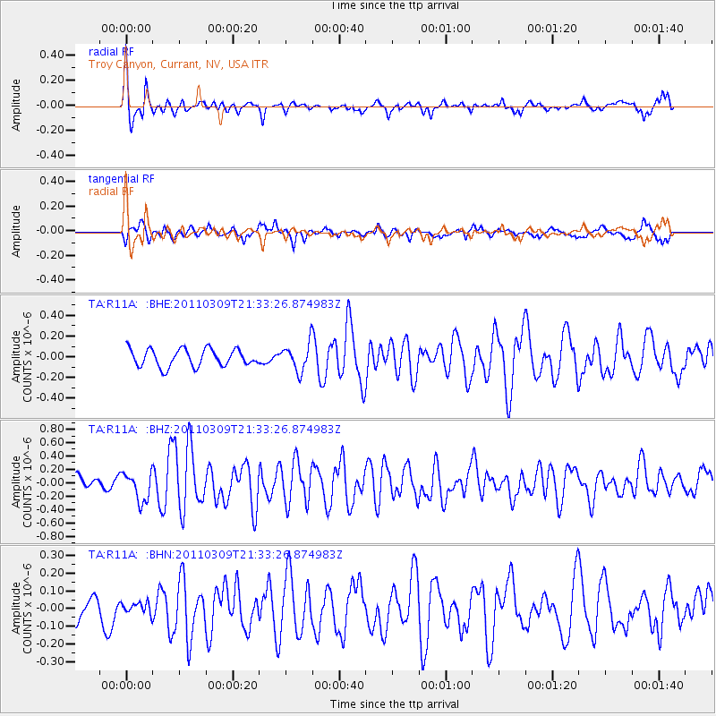
R11A Troy Canyon, Currant, NV, USA - Earthquake Result Viewer
*The percent match for this event was below the threshold and hence no stack was calculated.
| Earthquake location: |
Near East Coast Of Honshu, Japan |
| Earthquake latitude/longitude: |
38.3/142.6 |
| Earthquake time(UTC): |
2011/03/09 (068) 21:22:17 GMT |
| Earthquake Depth: |
23 km |
| Earthquake Magnitude: |
5.9 MB, 5.9 ME |
| Earthquake Catalog/Contributor: |
WHDF/NEIC |
|
| Network: |
TA USArray Transportable Network (new EarthScope stations) |
| Station: |
R11A Troy Canyon, Currant, NV, USA |
| Lat/Lon: |
38.35 N/115.59 W |
| Elevation: |
1756 m |
|
| Distance: |
75.2 deg |
| Az: |
52.77 deg |
| Baz: |
307.226 deg |
| Ray Param: |
$rayparam |
*The percent match for this event was below the threshold and hence was not used in the summary stack. |
|
| Radial Match: |
74.07049 % |
| Radial Bump: |
314 |
| Transverse Match: |
55.90336 % |
| Transverse Bump: |
400 |
| SOD ConfigId: |
354511 |
| Insert Time: |
2011-08-09 14:26:41.359 +0000 |
| GWidth: |
2.5 |
| Max Bumps: |
400 |
| Tol: |
0.001 |
|
Signal To Noise
| Channel | StoN | STA | LTA |
| TA:R11A: :BHZ:20110309T21:33:26.874983Z | 2.2567205 | 2.1729794E-7 | 9.6289256E-8 |
| TA:R11A: :BHN:20110309T21:33:26.874983Z | 0.42661622 | 3.147195E-8 | 7.3771105E-8 |
| TA:R11A: :BHE:20110309T21:33:26.874983Z | 1.6104827 | 1.3468703E-7 | 8.363147E-8 |
| Arrivals |
| Ps | |
| PpPs | |
| PsPs/PpSs | |


