You are here: Home > Network List > TA - USArray Transportable Network (new EarthScope stations) Stations List
> Station O33A Hebron, NE, USA > Earthquake Result Viewer
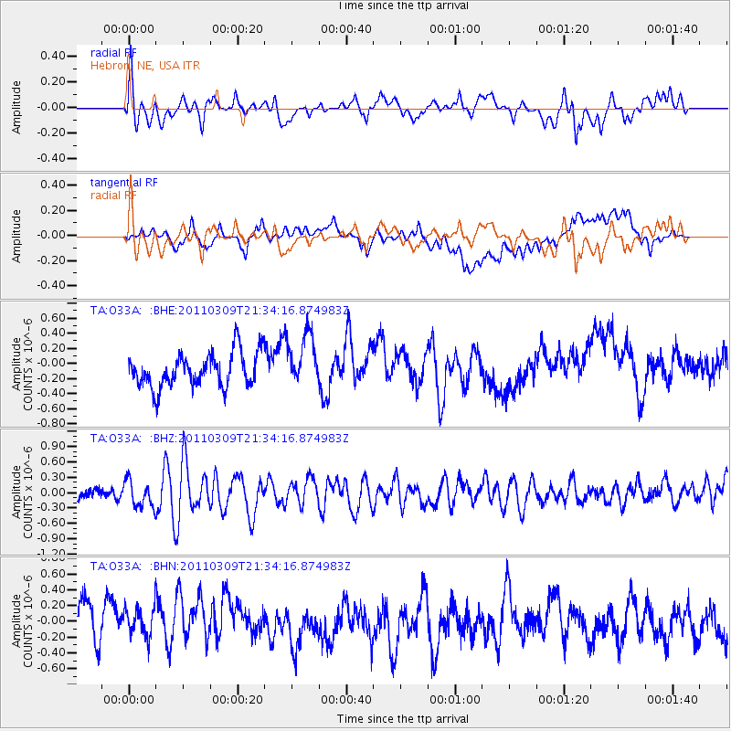
O33A Hebron, NE, USA - Earthquake Result Viewer
*The percent match for this event was below the threshold and hence no stack was calculated.
| Earthquake location: |
Near East Coast Of Honshu, Japan |
| Earthquake latitude/longitude: |
38.3/142.6 |
| Earthquake time(UTC): |
2011/03/09 (068) 21:22:17 GMT |
| Earthquake Depth: |
23 km |
| Earthquake Magnitude: |
5.9 MB, 5.9 ME |
| Earthquake Catalog/Contributor: |
WHDF/NEIC |
|
| Network: |
TA USArray Transportable Network (new EarthScope stations) |
| Station: |
O33A Hebron, NE, USA |
| Lat/Lon: |
40.08 N/97.58 W |
| Elevation: |
480 m |
|
| Distance: |
84.5 deg |
| Az: |
42.006 deg |
| Baz: |
316.704 deg |
| Ray Param: |
$rayparam |
*The percent match for this event was below the threshold and hence was not used in the summary stack. |
|
| Radial Match: |
47.180195 % |
| Radial Bump: |
400 |
| Transverse Match: |
47.021996 % |
| Transverse Bump: |
400 |
| SOD ConfigId: |
356183 |
| Insert Time: |
2011-08-09 15:22:38.298 +0000 |
| GWidth: |
2.5 |
| Max Bumps: |
400 |
| Tol: |
0.001 |
|
Signal To Noise
| Channel | StoN | STA | LTA |
| TA:O33A: :BHZ:20110309T21:34:16.874983Z | 1.4053229 | 2.554805E-7 | 1.8179489E-7 |
| TA:O33A: :BHN:20110309T21:34:16.874983Z | 0.90138113 | 2.0660586E-7 | 2.2921033E-7 |
| TA:O33A: :BHE:20110309T21:34:16.874983Z | 1.5465413 | 3.5043058E-7 | 2.2658986E-7 |
| Arrivals |
| Ps | |
| PpPs | |
| PsPs/PpSs | |


