You are here: Home > Network List > US - United States National Seismic Network Stations List
> Station WMOK Wichita Mountains, Oklahoma, USA > Earthquake Result Viewer
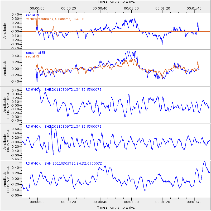
WMOK Wichita Mountains, Oklahoma, USA - Earthquake Result Viewer
*The percent match for this event was below the threshold and hence no stack was calculated.
| Earthquake location: |
Near East Coast Of Honshu, Japan |
| Earthquake latitude/longitude: |
38.3/142.6 |
| Earthquake time(UTC): |
2011/03/09 (068) 21:22:17 GMT |
| Earthquake Depth: |
23 km |
| Earthquake Magnitude: |
5.9 MB, 5.9 ME |
| Earthquake Catalog/Contributor: |
WHDF/NEIC |
|
| Network: |
US United States National Seismic Network |
| Station: |
WMOK Wichita Mountains, Oklahoma, USA |
| Lat/Lon: |
34.74 N/98.78 W |
| Elevation: |
486 m |
|
| Distance: |
87.7 deg |
| Az: |
46.375 deg |
| Baz: |
316.28 deg |
| Ray Param: |
$rayparam |
*The percent match for this event was below the threshold and hence was not used in the summary stack. |
|
| Radial Match: |
58.961155 % |
| Radial Bump: |
400 |
| Transverse Match: |
58.45572 % |
| Transverse Bump: |
400 |
| SOD ConfigId: |
356183 |
| Insert Time: |
2011-08-09 15:41:09.267 +0000 |
| GWidth: |
2.5 |
| Max Bumps: |
400 |
| Tol: |
0.001 |
|
Signal To Noise
| Channel | StoN | STA | LTA |
| US:WMOK: :BHZ:20110309T21:34:32.650007Z | 1.947586 | 1.8407631E-7 | 9.4515116E-8 |
| US:WMOK: :BHN:20110309T21:34:32.650007Z | 0.40740833 | 1.8153955E-7 | 4.4559604E-7 |
| US:WMOK: :BHE:20110309T21:34:32.650007Z | 0.3210135 | 5.853422E-8 | 1.8234194E-7 |
| Arrivals |
| Ps | |
| PpPs | |
| PsPs/PpSs | |


