You are here: Home > Network List > TA - USArray Transportable Network (new EarthScope stations) Stations List
> Station C38A Sawbill Landing (USFS), Superior Nat. Forest, MN, > Earthquake Result Viewer
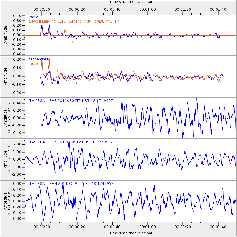
C38A Sawbill Landing (USFS), Superior Nat. Forest, MN, - Earthquake Result Viewer
*The percent match for this event was below the threshold and hence no stack was calculated.
| Earthquake location: |
Near East Coast Of Honshu, Japan |
| Earthquake latitude/longitude: |
38.3/142.8 |
| Earthquake time(UTC): |
2011/03/09 (068) 21:24:01 GMT |
| Earthquake Depth: |
15 km |
| Earthquake Magnitude: |
6.0 MB, 6.4 MS |
| Earthquake Catalog/Contributor: |
WHDF/NEIC |
|
| Network: |
TA USArray Transportable Network (new EarthScope stations) |
| Station: |
C38A Sawbill Landing (USFS), Superior Nat. Forest, MN, |
| Lat/Lon: |
47.72 N/91.27 W |
| Elevation: |
498 m |
|
| Distance: |
81.7 deg |
| Az: |
33.544 deg |
| Baz: |
319.918 deg |
| Ray Param: |
$rayparam |
*The percent match for this event was below the threshold and hence was not used in the summary stack. |
|
| Radial Match: |
74.697624 % |
| Radial Bump: |
400 |
| Transverse Match: |
55.47681 % |
| Transverse Bump: |
400 |
| SOD ConfigId: |
356183 |
| Insert Time: |
2011-08-09 16:09:38.376 +0000 |
| GWidth: |
2.5 |
| Max Bumps: |
400 |
| Tol: |
0.001 |
|
Signal To Noise
| Channel | StoN | STA | LTA |
| TA:C38A: :BHZ:20110309T21:35:48.174995Z | 2.6059005 | 5.159377E-7 | 1.9798827E-7 |
| TA:C38A: :BHN:20110309T21:35:48.174995Z | 2.3343596 | 3.672196E-7 | 1.5731065E-7 |
| TA:C38A: :BHE:20110309T21:35:48.174995Z | 2.106565 | 2.247612E-7 | 1.0669559E-7 |
| Arrivals |
| Ps | |
| PpPs | |
| PsPs/PpSs | |


