You are here: Home > Network List > CI - Caltech Regional Seismic Network Stations List
> Station BAR Barrett, Tecate, CA, USA > Earthquake Result Viewer
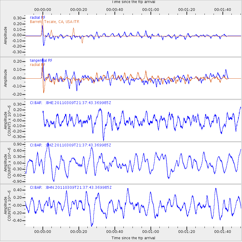
BAR Barrett, Tecate, CA, USA - Earthquake Result Viewer
*The percent match for this event was below the threshold and hence no stack was calculated.
| Earthquake location: |
New Britain Region, P.N.G. |
| Earthquake latitude/longitude: |
-6.0/149.8 |
| Earthquake time(UTC): |
2011/03/09 (068) 21:24:49 GMT |
| Earthquake Depth: |
29 km |
| Earthquake Magnitude: |
5.9 MB, 6.5 MS, 6.3 MW, 6.4 MW |
| Earthquake Catalog/Contributor: |
WHDF/NEIC |
|
| Network: |
CI Caltech Regional Seismic Network |
| Station: |
BAR Barrett, Tecate, CA, USA |
| Lat/Lon: |
32.68 N/116.67 W |
| Elevation: |
521 m |
|
| Distance: |
96.2 deg |
| Az: |
57.848 deg |
| Baz: |
266.872 deg |
| Ray Param: |
$rayparam |
*The percent match for this event was below the threshold and hence was not used in the summary stack. |
|
| Radial Match: |
60.510075 % |
| Radial Bump: |
400 |
| Transverse Match: |
46.72707 % |
| Transverse Bump: |
391 |
| SOD ConfigId: |
356183 |
| Insert Time: |
2011-08-09 16:24:34.906 +0000 |
| GWidth: |
2.5 |
| Max Bumps: |
400 |
| Tol: |
0.001 |
|
Signal To Noise
| Channel | StoN | STA | LTA |
| CI:BAR: :BHZ:20110309T21:37:43.369985Z | 1.8118091 | 5.196323E-7 | 2.8680302E-7 |
| CI:BAR: :BHN:20110309T21:37:43.369985Z | 0.682799 | 1.2382829E-7 | 1.8135393E-7 |
| CI:BAR: :BHE:20110309T21:37:43.369985Z | 2.6380506 | 1.793589E-7 | 6.7989184E-8 |
| Arrivals |
| Ps | |
| PpPs | |
| PsPs/PpSs | |


