You are here: Home > Network List > IC - New China Digital Seismograph Network Stations List
> Station KMI Kunming, Yunnan Province, China > Earthquake Result Viewer
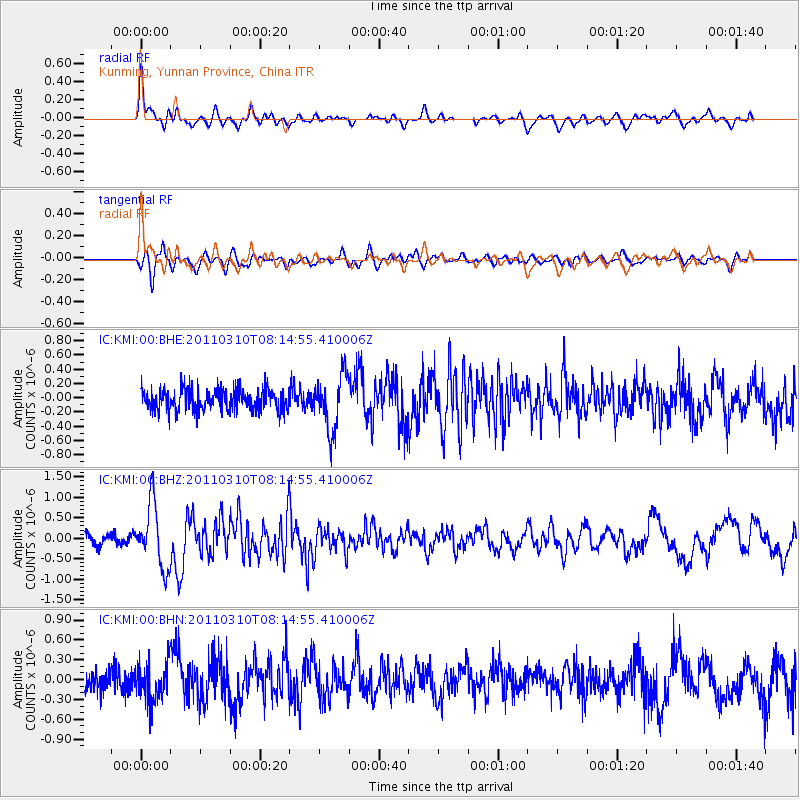
KMI Kunming, Yunnan Province, China - Earthquake Result Viewer
*The percent match for this event was below the threshold and hence no stack was calculated.
| Earthquake location: |
Off East Coast Of Honshu, Japan |
| Earthquake latitude/longitude: |
38.6/143.3 |
| Earthquake time(UTC): |
2011/03/10 (069) 08:08:20 GMT |
| Earthquake Depth: |
17 km |
| Earthquake Magnitude: |
5.7 MW, 5.3 MS, 5.4 MB, 5.6 MW |
| Earthquake Catalog/Contributor: |
WHDF/NEIC |
|
| Network: |
IC New China Digital Seismograph Network |
| Station: |
KMI Kunming, Yunnan Province, China |
| Lat/Lon: |
25.12 N/102.74 E |
| Elevation: |
1975 m |
|
| Distance: |
36.7 deg |
| Az: |
260.623 deg |
| Baz: |
58.518 deg |
| Ray Param: |
$rayparam |
*The percent match for this event was below the threshold and hence was not used in the summary stack. |
|
| Radial Match: |
78.232086 % |
| Radial Bump: |
400 |
| Transverse Match: |
67.20952 % |
| Transverse Bump: |
400 |
| SOD ConfigId: |
356183 |
| Insert Time: |
2011-08-09 16:42:13.351 +0000 |
| GWidth: |
2.5 |
| Max Bumps: |
400 |
| Tol: |
0.001 |
|
Signal To Noise
| Channel | StoN | STA | LTA |
| IC:KMI:00:BHZ:20110310T08:14:55.410006Z | 6.4408636 | 7.7609286E-7 | 1.2049516E-7 |
| IC:KMI:00:BHN:20110310T08:14:55.410006Z | 1.9354966 | 2.9253792E-7 | 1.5114361E-7 |
| IC:KMI:00:BHE:20110310T08:14:55.410006Z | 2.596067 | 3.8824186E-7 | 1.4955002E-7 |
| Arrivals |
| Ps | |
| PpPs | |
| PsPs/PpSs | |


