You are here: Home > Network List > TA - USArray Transportable Network (new EarthScope stations) Stations List
> Station G30A Faulkton, SD, USA > Earthquake Result Viewer
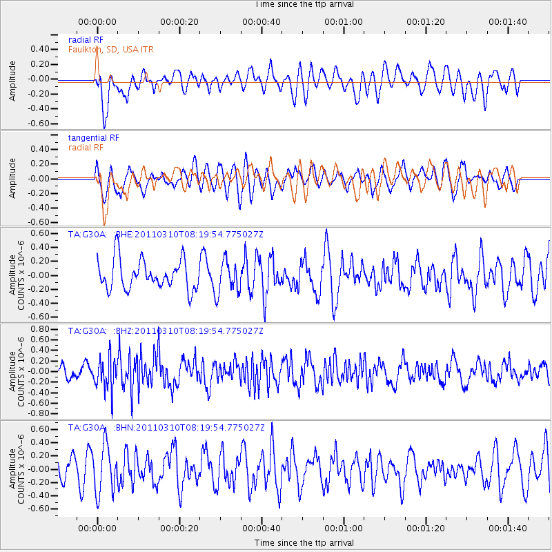
G30A Faulkton, SD, USA - Earthquake Result Viewer
*The percent match for this event was below the threshold and hence no stack was calculated.
| Earthquake location: |
Off East Coast Of Honshu, Japan |
| Earthquake latitude/longitude: |
38.6/143.3 |
| Earthquake time(UTC): |
2011/03/10 (069) 08:08:20 GMT |
| Earthquake Depth: |
17 km |
| Earthquake Magnitude: |
5.7 MW, 5.3 MS, 5.4 MB, 5.6 MW |
| Earthquake Catalog/Contributor: |
WHDF/NEIC |
|
| Network: |
TA USArray Transportable Network (new EarthScope stations) |
| Station: |
G30A Faulkton, SD, USA |
| Lat/Lon: |
45.13 N/99.14 W |
| Elevation: |
496 m |
|
| Distance: |
79.5 deg |
| Az: |
39.649 deg |
| Baz: |
315.069 deg |
| Ray Param: |
$rayparam |
*The percent match for this event was below the threshold and hence was not used in the summary stack. |
|
| Radial Match: |
49.239704 % |
| Radial Bump: |
400 |
| Transverse Match: |
56.07959 % |
| Transverse Bump: |
400 |
| SOD ConfigId: |
356183 |
| Insert Time: |
2011-08-09 16:58:52.358 +0000 |
| GWidth: |
2.5 |
| Max Bumps: |
400 |
| Tol: |
0.001 |
|
Signal To Noise
| Channel | StoN | STA | LTA |
| TA:G30A: :BHZ:20110310T08:19:54.775027Z | 3.0956333 | 3.0913478E-7 | 9.986156E-8 |
| TA:G30A: :BHN:20110310T08:19:54.775027Z | 1.876407 | 3.6618525E-7 | 1.9515235E-7 |
| TA:G30A: :BHE:20110310T08:19:54.775027Z | 1.0886295 | 2.3159919E-7 | 2.1274383E-7 |
| Arrivals |
| Ps | |
| PpPs | |
| PsPs/PpSs | |


