You are here: Home > Network List > TA - USArray Transportable Network (new EarthScope stations) Stations List
> Station MDND Maddock, ND, USA > Earthquake Result Viewer
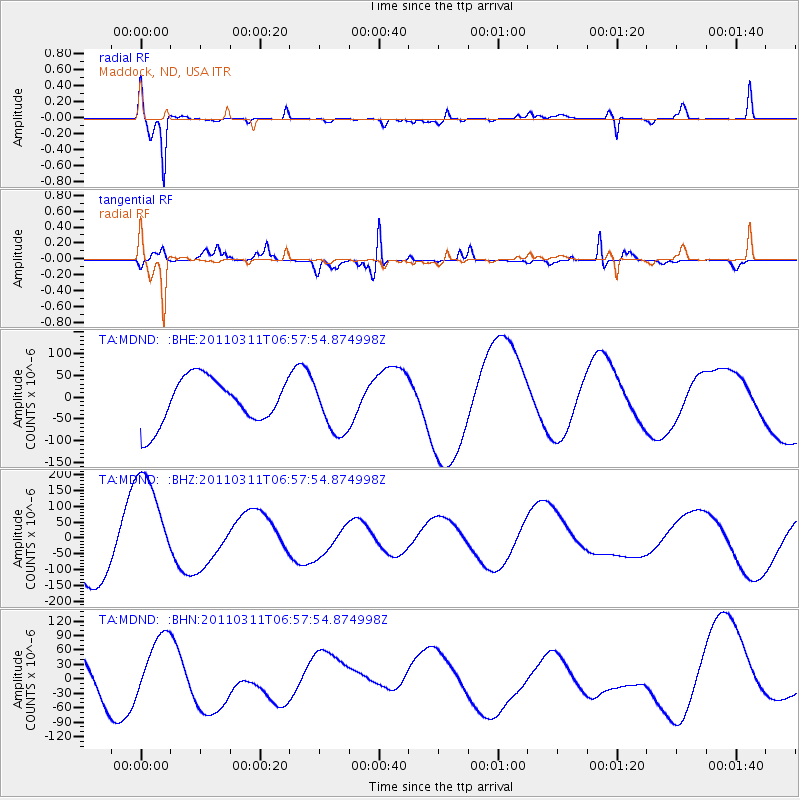
MDND Maddock, ND, USA - Earthquake Result Viewer
*The percent match for this event was below the threshold and hence no stack was calculated.
| Earthquake location: |
Off East Coast Of Honshu, Japan |
| Earthquake latitude/longitude: |
38.0/143.2 |
| Earthquake time(UTC): |
2011/03/11 (070) 06:46:31 GMT |
| Earthquake Depth: |
31 km |
| Earthquake Magnitude: |
5.9 MB |
| Earthquake Catalog/Contributor: |
WHDF/NEIC |
|
| Network: |
TA USArray Transportable Network (new EarthScope stations) |
| Station: |
MDND Maddock, ND, USA |
| Lat/Lon: |
47.85 N/99.60 W |
| Elevation: |
479 m |
|
| Distance: |
77.9 deg |
| Az: |
37.806 deg |
| Baz: |
313.996 deg |
| Ray Param: |
$rayparam |
*The percent match for this event was below the threshold and hence was not used in the summary stack. |
|
| Radial Match: |
79.780014 % |
| Radial Bump: |
314 |
| Transverse Match: |
66.12726 % |
| Transverse Bump: |
280 |
| SOD ConfigId: |
356183 |
| Insert Time: |
2011-08-10 19:40:21.486 +0000 |
| GWidth: |
2.5 |
| Max Bumps: |
400 |
| Tol: |
0.001 |
|
Signal To Noise
| Channel | StoN | STA | LTA |
| TA:MDND: :BHZ:20110311T06:57:54.874998Z | 2.166087 | 1.748652E-4 | 8.072862E-5 |
| TA:MDND: :BHN:20110311T06:57:54.874998Z | 1.7967998 | 6.382615E-5 | 3.5522127E-5 |
| TA:MDND: :BHE:20110311T06:57:54.874998Z | 1.15865 | 6.11679E-5 | 5.2792384E-5 |
| Arrivals |
| Ps | |
| PpPs | |
| PsPs/PpSs | |


