You are here: Home > Network List > TA - USArray Transportable Network (new EarthScope stations) Stations List
> Station S30A Montezuma, KS, USA > Earthquake Result Viewer
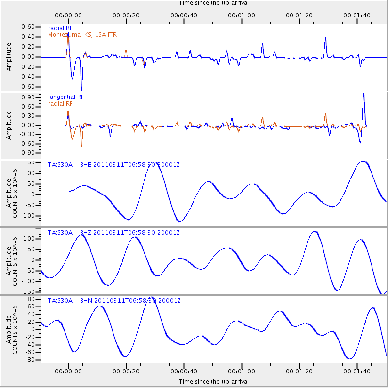
S30A Montezuma, KS, USA - Earthquake Result Viewer
*The percent match for this event was below the threshold and hence no stack was calculated.
| Earthquake location: |
Off East Coast Of Honshu, Japan |
| Earthquake latitude/longitude: |
38.0/143.2 |
| Earthquake time(UTC): |
2011/03/11 (070) 06:46:31 GMT |
| Earthquake Depth: |
31 km |
| Earthquake Magnitude: |
5.9 MB |
| Earthquake Catalog/Contributor: |
WHDF/NEIC |
|
| Network: |
TA USArray Transportable Network (new EarthScope stations) |
| Station: |
S30A Montezuma, KS, USA |
| Lat/Lon: |
37.64 N/100.46 W |
| Elevation: |
853 m |
|
| Distance: |
84.6 deg |
| Az: |
45.639 deg |
| Baz: |
314.609 deg |
| Ray Param: |
$rayparam |
*The percent match for this event was below the threshold and hence was not used in the summary stack. |
|
| Radial Match: |
91.500725 % |
| Radial Bump: |
324 |
| Transverse Match: |
40.94857 % |
| Transverse Bump: |
400 |
| SOD ConfigId: |
356183 |
| Insert Time: |
2011-08-10 19:41:58.039 +0000 |
| GWidth: |
2.5 |
| Max Bumps: |
400 |
| Tol: |
0.001 |
|
Signal To Noise
| Channel | StoN | STA | LTA |
| TA:S30A: :BHZ:20110311T06:58:30.20001Z | 1.1306027 | 9.8229364E-5 | 8.68823E-5 |
| TA:S30A: :BHN:20110311T06:58:30.20001Z | 0.72764313 | 4.2721185E-5 | 5.871173E-5 |
| TA:S30A: :BHE:20110311T06:58:30.20001Z | 2.4276485 | 1.3216467E-4 | 5.4441432E-5 |
| Arrivals |
| Ps | |
| PpPs | |
| PsPs/PpSs | |


