You are here: Home > Network List > UW - Pacific Northwest Regional Seismic Network Stations List
> Station MRBL Marblemount, WA, USA > Earthquake Result Viewer
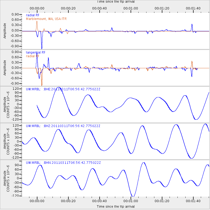
MRBL Marblemount, WA, USA - Earthquake Result Viewer
*The percent match for this event was below the threshold and hence no stack was calculated.
| Earthquake location: |
Off East Coast Of Honshu, Japan |
| Earthquake latitude/longitude: |
38.0/143.2 |
| Earthquake time(UTC): |
2011/03/11 (070) 06:46:31 GMT |
| Earthquake Depth: |
31 km |
| Earthquake Magnitude: |
5.9 MB |
| Earthquake Catalog/Contributor: |
WHDF/NEIC |
|
| Network: |
UW Pacific Northwest Regional Seismic Network |
| Station: |
MRBL Marblemount, WA, USA |
| Lat/Lon: |
48.52 N/121.48 W |
| Elevation: |
75 m |
|
| Distance: |
65.8 deg |
| Az: |
46.52 deg |
| Baz: |
300.379 deg |
| Ray Param: |
$rayparam |
*The percent match for this event was below the threshold and hence was not used in the summary stack. |
|
| Radial Match: |
82.898056 % |
| Radial Bump: |
212 |
| Transverse Match: |
83.27523 % |
| Transverse Bump: |
400 |
| SOD ConfigId: |
356183 |
| Insert Time: |
2011-08-10 20:13:01.086 +0000 |
| GWidth: |
2.5 |
| Max Bumps: |
400 |
| Tol: |
0.001 |
|
Signal To Noise
| Channel | StoN | STA | LTA |
| UW:MRBL: :BHZ:20110311T06:56:42.775022Z | 0.93737334 | 4.3415726E-5 | 4.6316367E-5 |
| UW:MRBL: :BHN:20110311T06:56:42.775022Z | 3.0019562 | 8.803401E-5 | 2.9325547E-5 |
| UW:MRBL: :BHE:20110311T06:56:42.775022Z | 0.8058374 | 6.5848224E-5 | 8.171404E-5 |
| Arrivals |
| Ps | |
| PpPs | |
| PsPs/PpSs | |


