You are here: Home > Network List > TA - USArray Transportable Network (new EarthScope stations) Stations List
> Station L44A Lake County Forest Preserve, Grayslake, IL, USA > Earthquake Result Viewer
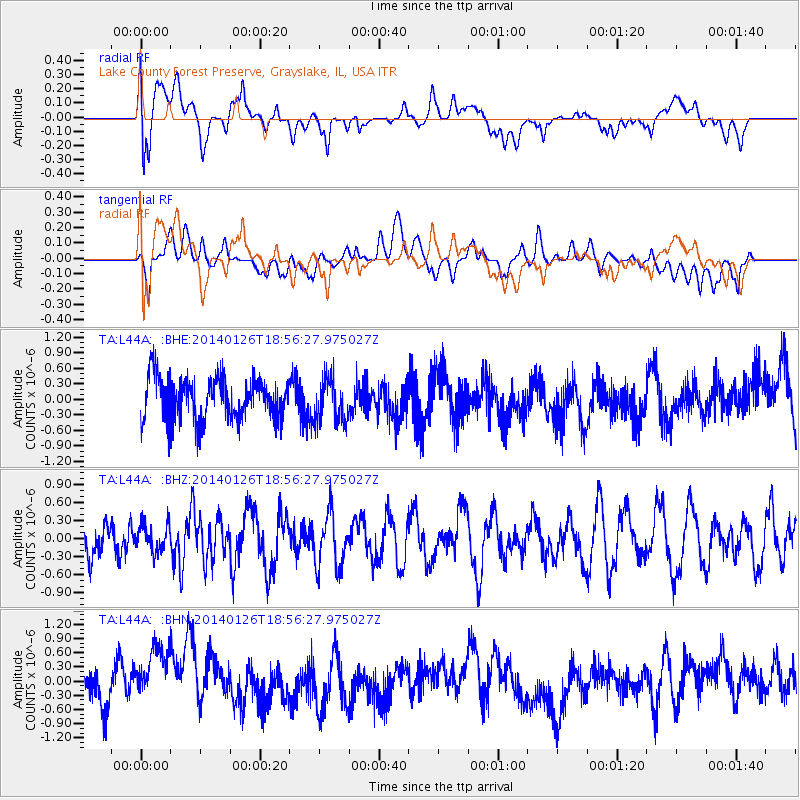
L44A Lake County Forest Preserve, Grayslake, IL, USA - Earthquake Result Viewer
*The percent match for this event was below the threshold and hence no stack was calculated.
| Earthquake location: |
Greece |
| Earthquake latitude/longitude: |
38.2/20.4 |
| Earthquake time(UTC): |
2014/01/26 (026) 18:45:08 GMT |
| Earthquake Depth: |
16 km |
| Earthquake Magnitude: |
5.4 MW |
| Earthquake Catalog/Contributor: |
ISC/ISC |
|
| Network: |
TA USArray Transportable Network (new EarthScope stations) |
| Station: |
L44A Lake County Forest Preserve, Grayslake, IL, USA |
| Lat/Lon: |
42.18 N/87.91 W |
| Elevation: |
202 m |
|
| Distance: |
76.8 deg |
| Az: |
313.547 deg |
| Baz: |
50.153 deg |
| Ray Param: |
$rayparam |
*The percent match for this event was below the threshold and hence was not used in the summary stack. |
|
| Radial Match: |
55.035786 % |
| Radial Bump: |
400 |
| Transverse Match: |
27.580526 % |
| Transverse Bump: |
400 |
| SOD ConfigId: |
3390531 |
| Insert Time: |
2019-04-10 03:28:57.115 +0000 |
| GWidth: |
2.5 |
| Max Bumps: |
400 |
| Tol: |
0.001 |
|
Signal To Noise
| Channel | StoN | STA | LTA |
| TA:L44A: :BHZ:20140126T18:56:27.975027Z | 0.5299942 | 2.2617807E-7 | 4.2675575E-7 |
| TA:L44A: :BHN:20140126T18:56:27.975027Z | 1.7508825 | 7.0426654E-7 | 4.022352E-7 |
| TA:L44A: :BHE:20140126T18:56:27.975027Z | 1.0228078 | 4.155157E-7 | 4.0625002E-7 |
| Arrivals |
| Ps | |
| PpPs | |
| PsPs/PpSs | |


